Viridien

Viridien (formerly CGG) is an advanced technology, digital and Earth data company.

More Info on Viridien

The company provides data, products, services and solutions in Earth science, data science, sensing and monitoring.

CGG rebranded and changed its corporate name to Viridien in June 2024.

Videos

Picture1
Sponsored
CGG announced the first multi-client ocean bottom node 3D survey in the Gulf of Mexico–Herschel field in the Mississippi Canyon.
Dec. 1, 2021

News

Courtesy Aker BP
Aker BP’s exploration strategy
Under the five-year arrangement, the Norwegian operator aims to deploy innovative techniques to support exploratory drilling and field development.
June 10, 2026
ID 24906005 © Vichaya Kiatyingangsulee | Dreamstime.com
New CEO named at Viridien
Viridien has promoted COO Henning Berg to CEO, with former CEO Sophie Zurquiyah becoming chair.
June 4, 2026
Courtesy Viridien
Time-Lag FWI technology_ Foz do Amazonas depth slice
The program covers 645 sq km in Norwegian and UK waters with complex subsurface geology.
May 18, 2026
Courtesy Viridien
Viridien seismic
The offshore eastern India project will address the complexities of thermogenic plays, while the shallow-water Guyana program will support future licensing.
March 12, 2026
Courtesy Viridien Earth Data
Laconia Phase I 12Hz E-TLFWI dataset in the US Gulf of Mexico
The collaboration will seek to strengthen the accuracy and speed of Viridien’s subsurface imaging services for the oil and gas and energy sectors.
Feb. 19, 2026
Courtesy Viridien Earth Data
Viridien completes reimaging of multi-client survey offshore Brazil
Viridien says that the ‘modern, high-fidelity 3D dataset’ will support exploration activity in the southern Santos basin.
Dec. 23, 2025
Courtesy Viridien
Viridien Full Waveform Inversion (FWI) model
The program involves use of Viridien's latest techniques to image potential hydrocarbon structures in Block 22, which will be offered in Angola’s next offshore licensing round...
Dec. 12, 2025
Courtesy Viridien
Laconia Phase III ultra-long offset ocean bottom node (OBN) survey
The ultra-long Laconia survey, performed by TGS and Viridien over the 151 OCS block area, are available to support bids for the forthcoming lease sale.
Nov. 12, 2025
Courtesy Wood Mackenzie Lens Upstream / Viridien
Selat Melaka 2D survey
The program, an initiative between Viridien and Malaysia Petroleum Management, has developed methodologies for interpreting the little explored basin offshore western Peninsular...
Oct. 23, 2025
Courtesy Viridien
Viridien imaging Laconia III OBN dataset over US Gulf Paleogene trend
Early results will be available to bidders for December’s offshore lease sale.
Sept. 19, 2025

Articles

Courtesy Viridien
Viridien_Full Waveform Inversion (FWI)
Viridien’s Rongxin Huang explains how advances in OBN acquisition and FWI are delivering more accurate velocity models and higher-fidelity imaging, enabling offshore operators...
June 25, 2026
Courtesy Viridien/TGS
Figure 1. seismic Amapa Phase I
Advances in seismic imaging are proving critical to unlock the hydrocarbon potential of promising frontier basins.
Aug. 26, 2025
Courtesy of Viridien Earth Data
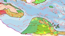
The map illustrates the total coverage of phases 1 and 2 of Viridien’s Gulf of Mexico Carbon Storage Screening Study.
Viridien has completed Phase 2 of the GeoVerse Carbon Storage Screening Study of the Gulf of Mexico (GoM).
Aug. 28, 2024
Image courtesy of Viridien Earth Data; Block and operator data sourced from Wood Mackenzie Lens Upstream © 2024
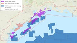
The map displays the location of Viridien’s new Laconia 3D OBN survey.
Viridien has started the Laconia 3D ocean-bottom node (OBN) multi-client seismic program in the US Gulf of Mexico.
Aug. 27, 2024
Courtesy Sercel
viridien_sercel_marlin_monitoring_2024
The system is designed to protect FPSOs and other offshore facilities against a range of marine risks.
June 17, 2024
Courtesy Sercel
The GPR300 was designed to excel in shallow-water depths down to 300 m.
Viridien (formerly CGG) has sold and delivered a GPR300 ocean-bottom node (OBN) for about $20 million.
June 12, 2024
Courtesy CGG
cgg_earth_data_cdi_map
CGG (rebranding soon as Viridien) has started two new multiclient 3D imaging programs offshore Côte d’Ivoire.
May 16, 2024
Courtesy CGG's "Technologies & Solutions Providing unique perspectives on our planet" presentation
cgg_name_change
After shareholder approval at CGG's annual general meeting on May 15, it has changed its corporate company name to Viridien.
May 16, 2024
Courtesy CGG
An example geological map was generated in 2021 from a study to help find the sweet spots for CO2 storage sites.
CGG and Baker Hughes have signed a memorandum of understanding to investigate collaborative solutions for carbon capture and storage (CCS).
May 8, 2024
Courtesy Sercel
PIKSEL is Sercel's high-resolution 3D marine seismic technology.
CGG geoscience expert identifies multiple uses for offshore seismic and surveying services
April 12, 2024

Additional content from Viridien

Source Wood Mackenzie Lens Upstream
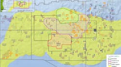
Momentum OBN data coverage in the US Gulf of Mexico
Viridien will incorporate new data from the Momentum offshore survey into its Laconia ocean-bottom node service, and it expects subsalt imaging benefits in the Garden Banks region...
Sept. 2, 2025
Courtesy Viridien
OMEGA Merge OBN dataset
A consortium of TGS, Axxis Multi-client and Viridien have completed final imaging of the OMEGA Merge dataset in the Norwegian North Sea.
July 15, 2025
Courtesy TGS
Laconia III map of seismic coverage.
This latest phase in the large-scale Laconia ocean-bottom node (OBN) survey program spans about 150 Outer Continental Shelf blocks in the Gulf of Mexico.
June 26, 2025
Courtesy Viridien
Viridien offshore logistics
Viridien (formerly CGG) has announced a sale of its Sercel Marlin offshore logistics management technology to ONGC, with the aims of enhancing operational efficiency and safety...
May 8, 2025
Courtesy Sercel
Sercel's new TPS marine seismic source
Sercel is deploying its Tuned Pulse Source for an unnamed geophysical contractor in the Gulf of Mexico (GoM).
Dec. 20, 2024
Courtesy Viridien and TGS
Viridien and TGS Complete Sleipner Ocean Bottom Node Survey
Viridien and TGS have delivered final processed data from their multi-client Sleipner Ocean Bottom Node (OBN) project in the Norwegian North Sea.
Dec. 13, 2024
Courtesy Viridien Earth Data
Post-Selat Melaka 2D image
Viridien has completed seismic imaging for the Selat Melaka multi-client 2D seismic project over the offshore area of the Langkasuka Basin in Malaysia.
Dec. 11, 2024
Courtesy Geoscience Australia
Bonaparte Basin map
Viridien and SLB have concluded acquisition of a new 3D multiclient seismic survey in the Bonaparte Basin offshore Australia’s northwest coast.
Oct. 24, 2024
Courtesy MDO
Viridien multispectral processing
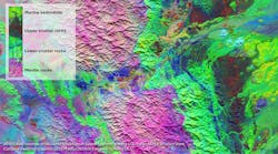
Viridien says that it will help Oman identify, map and rank mineralization prospectivity potential across seven concessions.
Sept. 19, 2024
Courtesy CGG Earth Data
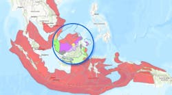
Overview of basins covered by the Southeast Asia Carbon Storage Study and snapshot of storage play segmentation
CGG has issued its Southeast Asia Carbon Storage Study, an addition to its expanding Geoverse carbon storage portfolio that includes studies for the North Sea and the US Gulf ...
Feb. 20, 2024
Courtesy CGG
geothermal_offshore
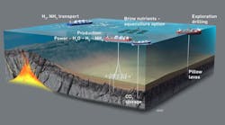
CGG's research suggests there could be vast geothermal resources along the magmatically active ocean floor-spreading centers and adjacent flooded rift systems in all the world...
Feb. 13, 2024
Courtesy CGG
cgg_trinidad and tobago_reprocessing
CGG has signed an agreement with Trinidad and Tobago’s Ministry of Energy and Energy Industries to re-image vintage 3D seismic data over blocks 25a, 25b, 26 and 27.
Jan. 24, 2024