Offshore staff
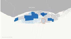
OSLO, Norway — PGS has issued details of its current project to process more than 2,000 sq km of new broadband 3D seismic data offshore Côte d’Ivoire, due for delivery next month.
In recent years there have been various reported discoveries made in and around the shelf edge, notably Springfield’s Afina-1 offshore Ghana in 2019 and Eni’s subsequent expansion of volumes in the deepwater Baleine structure offshore Côte d’Ivoire.
Two main plays have been the focus for exploration in the Tano Basin. The syn-transform Lower Cretaceous play dominates the area around the shelf edge in both the Ghanaian and Ivorian offshore, with source-rock maturation history a major factor.
According to PGS, Berriasian to Albian source rocks sit within the gas maturity window around the shelf due to a relatively thinner overburden but are likely to be over-mature in more distal syn-transform basins where burial depth is greater.
There are accompanying Albian-aged fluvial to shallow marine syn-transform sandstones, as proven in the Baobab Field offshore Côte d’Ivoire, discovered by CNR in 2001.
The post-transform Upper Cretaceous system has proven most successful around and outboard of the present shelf edge due to the thick clastic section allowing for burial of shallower Cenomanian-Turonian source rocks, which have mixed oil and gas potential. Baleine, a shelf-edge structure, represents the Upper Cretaceous play.
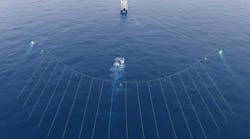
PGS has paired its latest GeoStreamer data acquisition with modern broadband processing techniques to achieve clearer imaging of structures, faults and traps. The AVO-compliant prestack data should help uncover subtle depositional features, the company added, de-risking future exploration.
07.20.2023


