Laser scanning gathers 'as-built' data for offshore installations
John M. Rothermel
Robert N. Bourbeau
Quantapoint Inc.
The challenges of executing projects on offshore platform facilities are many. Safety, quality, schedule, and cost suffer due to the lack of any "as-built" documentation. Now there is a tech-nology that is fast becoming the tool of choice to overcome the problems presented by the absence of as-built data.
Laser scanning is a proven technique for the collection of as-built data for offshore facilities. In fact, laser scanning offers significant advantages over traditional surveying techniques, and any organization engaged in the modification of offshore platforms is poised to reap the rewards – returning as much as five to 10 times the investment in laser scanning services.
Laser scanning is a new alternative to manual dimensional data collection techniques, replacing tape measures, clipboards, calculators, and other surveying tools. Project teams are increasingly called upon to adopt this new technology, but, to date, little information has been written about its applications and benefits.
null
Many offshore facilities require frequent revamp or modification. These changes are typically made to increase production capacity, upgrade or replace equipment, maintain mechanical integrity, address safety or environmental concerns, or support other mission-critical needs. Work teams must be transported by boat or helicopter to measure existing facilities or equipment such as piping, structures, vessels, pumps, valves, tanks, heat exchangers, or electrical components. These work teams capture dimensional data manually and then either mark up existing hard copy drawings or generate new drawings. This information then becomes the basis for detailed engineering design. Even then, after spending the time, effort, and money in the process of capturing the data manually, most owners and operators of offshore facilities anticipate error in the results. Thus, some level of hotwork is still required because of the unreliability of the data that was captured manually.
Any and all project stakeholders – owners and operators, engineers, designers, maintenance personnel, project managers, and equip- ment vendors – might consider laser scanning as a better dimensional data capture solution for offshore revamp projects.
Laser scanning technology was introduced in the late 1990s and provides a three-dimensional representation of whatever is being scanned. Individual laser scanned data can be used to generate a photo-realistic, dimensionally accurate, 360° panoramic image of a scene or object. A network of many laser scans can result in a 3D model of an entire offshore facility and any measurement, depending on the technology used and the work process employed in the field, is accurate to within 1/4 in.
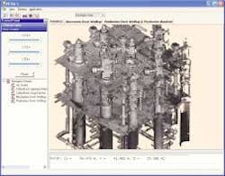
A laser scanner uses a volumetric measurement device to generate 3D data. A trained field crew collects the data, which is then processed. Software allows its user to display the scanned data in standard 3D CAD applications. This capability enables the project team to perform many functions such as dimensional extraction, creating 2D drawing deliverables, and performing "interference checking" without leaving the safety and comfort of the office. Additionally, software is available that can superimpose CAD models directly onto the laser scanning model to assess design accuracy and installation fit-up.
The net result for using laser scanning in an offshore application is delivery of a virtual platform to a workstation located anywhere in the world. This virtual platform can be used to support all phases of capital project execution. It virtually eliminates travel to the site for project development and execution. Project teams have used laser scanning data to successfully develop all traditional engineering design documents, including piping and instrumentation diagrams (P&IDs), steel framing plans, piping isometrics, plan drawings, and elevation drawings. In addition, the laser-scanned data remains available as an alternative to actually traveling offshore and its use extends well beyond the life of the project.
The benefits of laser scanning technology for offshore applications include:
- Improved accuracy and precision reduces many of the risks associated with offshore project execution
- Accurate and detailed information im-proves engineering designs and decisions that affect construction and start-up
- Projects that were once only viable in 2D can now be executed using 3D CAD tools
- Costs associated with hotwork, construction rework, and field fit-up welds are minimized.
Authors
John M. Rothermel, P.E., is vice president of business development for Quantapoint. Rothermel holds a Bachelor of Science degree in Civil Engineering and a Master of Business Administration degree from Villanova University. He is a registered professional engineer licensed in the State of Pennsylvania.
Robert Bourbeau, director of business development for Quantapoint, serves clients and strategic partners in the oil and gas, refining, petrochemical, process chemical, and power markets in the Gulf of Mexico region. Bourbeau has a Bachelor of Science degree in chemical engineering from the University of Oklahoma.

