GEOSCIENCES
Victor Schmidt
Deepwater carbonates
What is the most oil-prolific rock type? The obvious answer is the carbonates of the Middle East, stromatolite algal mats layered like lasagna. These biologically-produced rocks developed in warm, clear, shallow-water seas that were relatively quiet. Much of the explorationist's search for new carbonate reservoirs has been guided by the dream of finding similar biologically-produced accumulations. The search focuses on finding other regions with paleo-climates that supported algal mats. Few similar environments have been located, and none reach the size of the Middle East fields.
Oolite banks, tropical reefs, and chalks are other carbonate forms that hold producible oil. Again warm, clear, shallow water is the preferred environment of deposition. But what if other climates also were conducive to carbonate production? What if we could find other carbonate reservoirs as large and prolific as the Middle East? Where would we look? Perhaps we should scan the deepest oceans.
Recent reports in Science detail deepwater corals found by Norwegian and other re-searchers. The new deepsea probes revealed and recovered "cool corals" from very deep water.
This turns traditional carbonate thinking on its head. Warm, clear, shallow water is not the only environment suitable for carbonate development and deposition. More to the point, the corals are found around the world:
- A 30-m high by 14-km long coral structure in 250-m water depth along the Sula Ridge
- Coral gardens on seamounts in 600-m water depth off the coast of Ireland and Scotland
- 100-sq-km of seafloor reefs off Canada
- Deepwater corals off the Aleutian Islands.
These discoveries open the potential for major carbonate accumulations in very deep water that developed over very long times.
The deep oceans are not simply the final repository of fine silt and mud. They hold the potential for carbonate reservoirs at very great water depths. That potential could hold vast, new, deepwater oil reserves.
More jobs
A recent report from the American Geological Institute shows an improving job market for earth science PhDs. The study reviewed years 1996-2001 by surveying recent graduates. Industry jobs continue to pay the best, and the average time before finding a job dropped to 3.6 months from a high of 5.5 months during 1998.
Men still dominate the number of doctoral awards, but the women's proportion has grown steadily from 22% in 1996 to 32% in 2001. The full report is available on the web at http://www. agu.org/sci_soc/cpst/2001PhdSurvey.pdf.
Electromagnetic sensing
OHM Ltd. has developed a new active electromagnetic sounding system. The system consists of a set of sea bottom sensors and a towed electromagnetic source. The 6,000-m tow cable uses a central signal-carrying fiber-optic component with electrical power cores laid over the center and sheathed in polyurethane. Two layers of ultra-high tensile galvanized wire armor cover the polyurethane sheath.
null
The cable supplies power and signals to a towed body containing the electromagnetic source. The source transmits a complex electromagnetic signal via the second element of the cable system. This 300-m active element is towed by the source and has an electric dipole to transmit the signal into the earth. Resultant electromagnetic fields are detected and logged by an array of seafloor-mounted receivers.
The hydrocarbon mapping method has been proved in the North Sea, off West Africa, and in the Gulf of Mexico, where it has detected and delineated oil and gas reservoirs in deepwater.
UK bathymetry
The British Geological Survey released DigBath250, version 1.0, a vector, attributed digital bathymetry of UK and adjacent European waters. The regional-scale digital bathymetry provides a primary dataset for geographic information systems and for mapping and modeling the seabed and sub-seabed. It was produced for non-navigation applications only.
The coverage is divided into six sectors: Northern North Sea, Southern North Sea, English Channel, South West Approaches, Irish Sea, and North West Scotland.
For specification and license information, contact Ceri James at tel.: +44 (0) 115-936-3467, or check the website: http://www.bgs.ac.uk/products/digbath250/home.html.
Visionarium
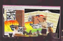
Paradigm has installed a new Visionarium in its Houston offices. The 1,300-sq-ft facility uses a Mechdyne MD WALL visualization system combining a panoramic, 18-ft-wide, rear-lit screen with edge-blended Christie Mirage 4000 projectors and control facilities. Computers from SGI, Sun Microsystems, IBM, and Hewlett-Packard will drive the system.
null
Visual archiver
Landmark Graphics has released its Corporate Data Archiver, a Web-based data management tool for storing and protecting the digital assets of upstream companies. This new system allows rapid retrieval of critical data and knowledge, reducing project rework or data reacquisition. It visually records a project, automatically creating a snapshot of selected data, which eliminates the need to restore project data for searches.


