SATELLITE GRAVITY MAPPING Petroscan mapping, interpreting India's offshore geology
- On Petroscan's Bouguer Gravity map of Canada's Eastern Continental Margin, areas of mass deficit representing basement depressions where sedimentary deposition may have taken place are shown in blue. This corresponds closely to the central part of the Jeanne d'Arc Basin, in which discoveries have been made.
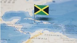
The merits of satellite gravity mapping have been recognized by India's Directorate General of Hydrocarbons (DGH), which has contracted Petroscan to map all its offshore areas.
In mid-year, the Gothenburg-based company had finished its work on the western waters and moved on to the eastern sector. In addition to the actual mapping, it is also providing DGH with interpretation services in the form of geological reports based on the maps, according to Petroscan president Bert Lundgren.
The final report, which is due to be submitted in 1997, will be included in various geophysical data packages which DGH will sell to companies interested in applying for licences. From Petroscan's work, the directorate itself will also have a good overall guide to prospective areas within its waters.
Satellite gravity mapping uses radar altimetry to measure undulations in the sea surface which reflect density variations in the earth's upper crust. It enables areas of mass surplus and mass deficit to be identified: areas of mass deficit correspond to basement depressions, where sedimentary deposition is likely to have taken place.
More and better data
The potency of satellite gravity mapping as an oil and gas exploration tool has been substantially advanced by the development of CPU computer capacity and the growing richness of satellite data, Lundgren says. Two important advances took place last year on the data front: first, the availability of dense altimeter data from the ERS-1 satellite operating in geodetic mode, and second, the release of previously classified dense altimeter data (geodetic data) from the US Navy's GEOSAT satellite.
Petroscan's work uses data from three satellites: Geosat (GM and ERM modes), ERS-1 and Topex Poseidon; the latter two are still flying. The feast of data which is available enables stringent editing criteria to be imposed in the processing phase which ensure that the data points to be used for further processing are accurate, Lundgren says.
Hibernia, Terra Nova
The geoid (flat sea surface) data provided by the satellites are converted to "free-air" gravity data. These in turn are compensated for the influence of sea floor topography using Petroscan's own patented technique. From the compensated data is derived a Bouguer Gravity map on which the areas of mass surplus and mass deficit are clearly identified. The Bouguer Gravity map which Petroscan has computed for Canada's Eastern Continental Margin, for example, shows a close correspondence between areas of sedimentary accumulations and the parts of the Jeanne d'Arc basin in which the Hibernia, Terra Nova and a series of other oil and gas finds have been made.
These developments have strengthened the competitive position of satellite gravity mapping against the claims of marine and airborne gravity. Not only is data acquisition itself less expensive, but the resolution achieved using satellite data is much greater - a height or dip can be measured to within two milligalls, compared with a practical best of three-five milligals for a shipborne survey covering the same, normally very large, offshore area, Lundgren says.
With the aid of Pentium Pro computers, Petroscan has refined its processing techniques, making much of the work semi-automatic, a move which has enabled it to cover much larger areas at a time. It is currently carrying out speculative surveys around the Falklands in the South Atlantic, around the Hibernia Field off Canada's east coast, off Gabon and off the Ivory Coast.
The oil industry istarting to recognize the benefits of satellite gravity mapping, Lundgren says. To some extent it is replacing regional seismic surveys and is being used to plan more detailed seismic. Its full potential, however, has yet to be realized by the industry, in his view.
For more information contact Bert Lundgren, Petroscan: telephone +46 31 10 17 20 or fax +46 31 13 51 84.
Copyright 1996 Offshore. All Rights Reserved.


