PGS revises Barents Sea well atlas

Offshore staff
LYSAKER, Norway – PGS has updated its interactive Barents Sea rockAVO Atlas.
This now provides data on 144 wells in the region, including 18 drilled since 2018.
Data is said to be available on all relevant wells, and more than 17 different reservoirs have been modelled. According to PGS, this provides a consistent interactive reference database of petrophysics and rock physics for the region.
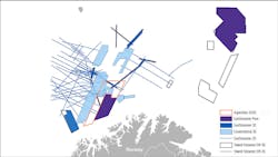
Included in the latest update is the 7121/8-1 Blåmann well, a discovery in the Jurassic Stø formation of the Hammerfest basin; 7121/5-2 (Snøhvit Beta), 7122/7-3 (Goliat), 7120/12-2 (Alke Sør); and Equinor’s 7435/12-1 Korpfjell well, a gas discovery in the Jurassic Stø and Triassic Kobbe formations.
The latter has been integrated with the PGS GeoStreamer PURE (ST14005) seismic survey, and the results should help de-risk other prospects in the frontier southeastern Barents Sea, the company said.
Earlier this week PGS’ Ramform Tethys vessel began acquiring its latest ultra-high-density seismic survey in the Barents Sea, designed to extend Hammerfest basin coverage farther west and north into the southern Loppa High. First data will be available during 4Q.
The acquisition geometry is said to build on a configuration previously applied on the PGS18004NBS survey, applying a wide-tow source configuration in combination with an ultra-high-density GeoStreamer setup.
This season, PGS will look to obtain more near offsets by extending the survey geometry used on the 2018 program to push the towing limits achievable from a single vessel.
The technical set-up, including wide-source spread, high-density streamers, and long tails for FWI, has been adapted to more precisely image shallow targets without compromising illumination of targets at deeper levels.
07/09/2020