Ted Moon • Houston
Rockhopper completes Falklands surveys
A 2D seismic survey and electromagnetic surveys performed on behalf of Rockhopper Exploration Plc on its Falkland Islands acreage have been completed.
The 2D seismic survey, completed by GSI, acquired approximately 920 km of data over Rockhopper’s exclusive PL023 and PL024 licenses.
The new data will be processed in the UK and then interpreted and integrated with the existing 1,832 km of 2D data on the licenses.
A number of leads and the J1 prospect have already been identified on these licenses. Rockhopper hopes that the new mapping will enhance J1 and also identify several of the leads as true prospects.
Offshore Hydrocarbon Mapping Plc completed the controlled source electromagnetic (CSEM) surveys over the PL023 and PL024 licenses. While CSEM has been used successfully elsewhere by several major oil companies, this survey marks the first one of its type carried out in the Falklands.
Processing and interpretation of all surveys is expected to take approximately three to four months.
A2D Technologies expands into offshore NW Europe
A2D Technologies, a TGS-NOPEC company, now offers online access to multi-component GeoData sets for online access and instant download via its web-based system, LOG-LINE Plus!, for hydrocarbon provinces offshore Northwest Europe, including the North Sea, Norwegian Sea, Barents Sea, and offshore west Ireland.
The GeoData sets include: edited well log data, interpreted borehole litho-, sequence- and chrono- stratigraphy, synthetic seismograms, modeled borehole zonations to include lithology, and main depositional environment and depositional facies associations. GeoData sets are available online for over 2,200 key wells offshore the UK, Norway, and Ireland.
A2D has also signed an agreement with the UK Department of Trade and Industry (DTI) to become an authorized data release agent. A2D will offer standardized high-quality log data from the UKCS on behalf of the DTI.
All new releases will be available through LOG-LINE Plus. A2D will also collect and standardize all legacy exploration and appraisal UKCS wells to industry standards and create value-added products, all of which will also be accessible online.
TGS plans new GoM survey
TGS-NOPEC Geophysical Co. (TGS) will acquire a new multi-client 3D seismic survey in the areas of Garden Banks, Keathley Canyon, Green Canyon, and Walker Ridge located offshore Louisiana and Texas in the GoM.
The new program, named Stanley, covers approximately 600 deepwater OCS blocks (14,000 sq km) and focuses on an area of expected high lease turnover over the next several years. Forty percent of the current leases are scheduled to expire over the next three years with 22% of existing leases expiring in 2007. Currently, 24% of the OCS blocks are available for leasing.
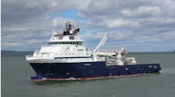
TheMV Polar Searchwas slated to begin data acquisition early this month. An area covering approximately 200 OCS blocks will be recorded, processed, and delivered in advance of the 2007 Central GoM OCS lease sale. Acquisition of the entire 600-block project is expected to last approximately 13 months.
“The complex geology in the Stanley area has historically been extremely challenging to properly image. TGS will incorporate 9,000-m streamer offsets and a host of advanced pre-stack imaging techniques to generate multiple output volumes, including both wave equation and Kirchhoff pre-stack depth products.
“Use of advanced technology in concert with the turnover of leases in the area will provide TGS and its clients a commercially significant project for advancing exploration in this difficult area for quite some time,” says Kim Abdallah, TGS’ VP of new ventures in North and South America.
Aral Sea seismic work to start in May
An international consortium of E&P companies is to start seismic exploration work for oil and gas in the Uzbek sector of the Aral Sea starting mid-May, according to Uzbekneftegaz Chief Engineer Shavkat Mazhitov.
Russia’s Lukoil, Uzbekistan’s Uzbekneftegz, China National Petroleum Corp., Korean National Oil Corp., and Malaysia’s Petronas formed a consortium in September 2005 to develop the Uzbek sector of the Aral Sea. The project will be implemented under a production sharing agreement.
“We plan to complete the negotiation process by April 5 and to sign a PSA agreement, and then within a month hold all the tenders for sub-contract work,” Mazhitov says.
The Aral Sea has seismic seasons that run from April to November.
“We need to do everything not to miss this season,” says Mazhitov.
The project will have three stages. The first, costing a tentative $80 million, will involve seismic exploration work over 3,000 linear m and will take from two to three years.
The second stage will cost at least $20 million and will involve drilling of wells at structures that have been discovered. The third stage will include preparations for development and the subsequent development of fields.
According to Uzbekneftegaz, the Aral Sea holds potentially more than 30 anomalies indicating oil and gas prospects.
Fugro plans Asia-Pacific 3D seismic survey
Fugro-Geoteam AS has been awarded a large 3D marine seismic contract in the Asia-Pacific region. The survey will cover deepwater areas of approximately 5,000 sq km.
The work will be carried out by Fugro’s new vessel,Geo Atlantic, from October 2006 to May 2007, directly upon completion of the vessel’s earlier announced work for Statoil in Norway, which is scheduled to start in May/June 2006.•


