TGS advances Equatorial Guinea survey as Shearwater and Viridien push seismic, data capabilities

Recent developments across the geoscience sector point to ongoing efforts to expand seismic coverage, enhance reservoir monitoring and modernize subsurface data management.
Key highlights:
- TGS is progressing a large-scale offshore survey program in Equatorial Guinea.
- Shearwater Geoservices has secured work supporting ExxonMobil’s activities offshore Guyana.
- Viridien has introduced a new AI-enabled platform aimed at improving access to and use of geoscience data.
TGS advances Equatorial Guinea MegaSurvey
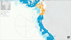
TGS has signed an accord with Equatorial Guinea’s Ministry of Hydrocarbon and Mining Development of the Republic of Equatorial Guinea to develop a multi-client offshore MegaSurvey.
The first planned phase involves post-stack reprocessing of about 27,273 km of legacy 2D seismic data and about 35,000 sq km of 3D seismic data. The task should be completed during the third quarter.
MegaSurveys, TGS explained, are harmonized 3D seismic datasets covering large contiguous areas. Their purpose is to strengthen confidence in geological interpretation, improve understanding of structural and stratigraphic frameworks, and reduce exploration uncertainty.
The longer-term plan is to create a seamless seismic data product across Equatorial Guinea’s offshore basins, which would comprise about 46,343 line km of 2D data and more than 59,000 sq km of 3D data.
“The Equatorial Guinea MegaSurvey is the first of its kind in the country and will apply TGS’ latest imaging technology to address key subsurface challenges and support exploration risk reduction across the Rio del Rey and Rio Muni basins," David Hajovsky, EVP of Multi-Client at TGS, said. “The product is designed to provide customers with a basin-wide regional screening tool, supporting prospect identification, prospect ranking and planning for future work commitments.”

TGS also just secured a streamer acquisition contract in the Africa and Middle East region. A 3D Ramform vessel is scheduled to start acquisition work in early September, and the contract has a duration of about 55 days.
Shearwater to support ExxonMobil seismic campaign offshore Guyana
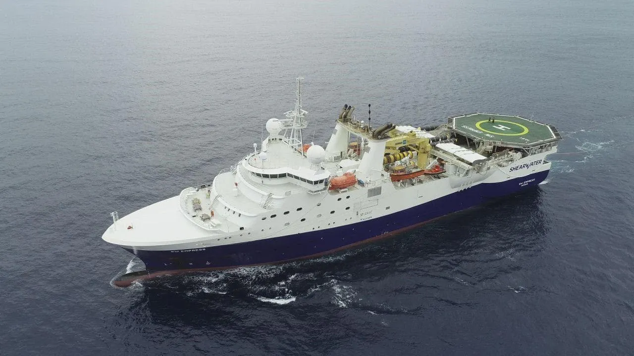
ExxonMobil has contracted Shearwater GeoServices for a two-month, source-only seismic acquisition program in the Stabroek Block offshore Guyana.
This will support a baseline distributed acoustic sensing (DAS) reservoir surveillance survey over the Yellowtail Field development area.
Shearwater is deploying the SW Empress vessel in a triple source configuration, in direct continuation of another project offshore South America where the vessel has been operating since last November.
“DAS programs may provide clients with specific insights into reservoir surveillance throughout a field’s life," CEO Irene Waage Basili said. “Shearwater’s source technology, offshore execution experience and flexible capacity enable vessels to switch between different modes to maximize vessel utilization.”

Viridien launches AI-driven subsurface data platform
In another geoscience development, Viridien has released its Evergreen Data Solution, an AI-powered approach to subsurface data transformation.

The company says this system is designed to help teams access and use complex data more quickly, leading to reduced cycle times and better decisions on exploration and development.
Evergreen is also claimed to address issues typically encountered with growing volumes of fragmented subsurface data by making it more readily available, validated and analytics-ready.
The technology is also designed to automatically ingest, standardize and deliver data across files, systems of record, and applications, managing unstructured, semi-structured and structured formats to create a unified, interpretation-ready and AI-ready data process.
Evergreen “combines AI, data science and domain expertise to form a live, continuously updated data foundation of all available geoscience and seismic data," Peter Whiting, EVP of Geoscience, said. "It interacts with data of all types and the third-party applications commonly used by our clients. The data foundation provides the full set of decision-quality data that rapidly improves exploration and production outcomes and enables further AI-based advanced analytics.”

About the Author

Jeremy Beckman
Editor, Europe
Jeremy Beckman has been Editor Europe, Offshore since 1992. Prior to joining Offshore he was a freelance journalist for eight years, working for a variety of electronics, computing and scientific journals in the UK. He regularly writes news columns on trends and events both in the NW Europe offshore region and globally. He also writes features on developments and technology in exploration and production.