Viridien to image/re-image 3D seismic data offshore Guyana, India
Viridien has committed to two new 3D initiatives offshore India and Guyana.
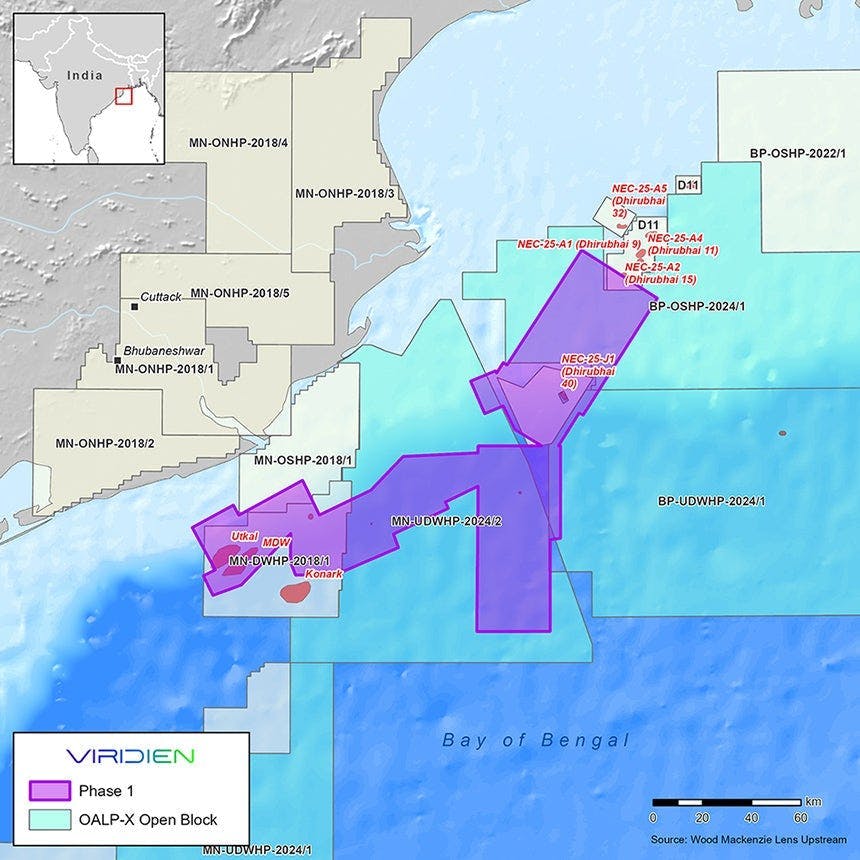
Exploration for India’s offshore basins
Fast-track results should be issued by June, followed by final data around the end of the year.
Viridien said Phase 1 should deliver improved imaging over proven petroleum system areas and deeper water regions. Here, exploration of new thermogenic plays has been problematic due to low-quality imaging of legacy data.
Solutions will include use of modern imaging technologies such as time-lag full-waveform inversion (TLFWI) and least-squares PSDM (LSQPDSM).
Seismic program over shallow-water Guyana acreage
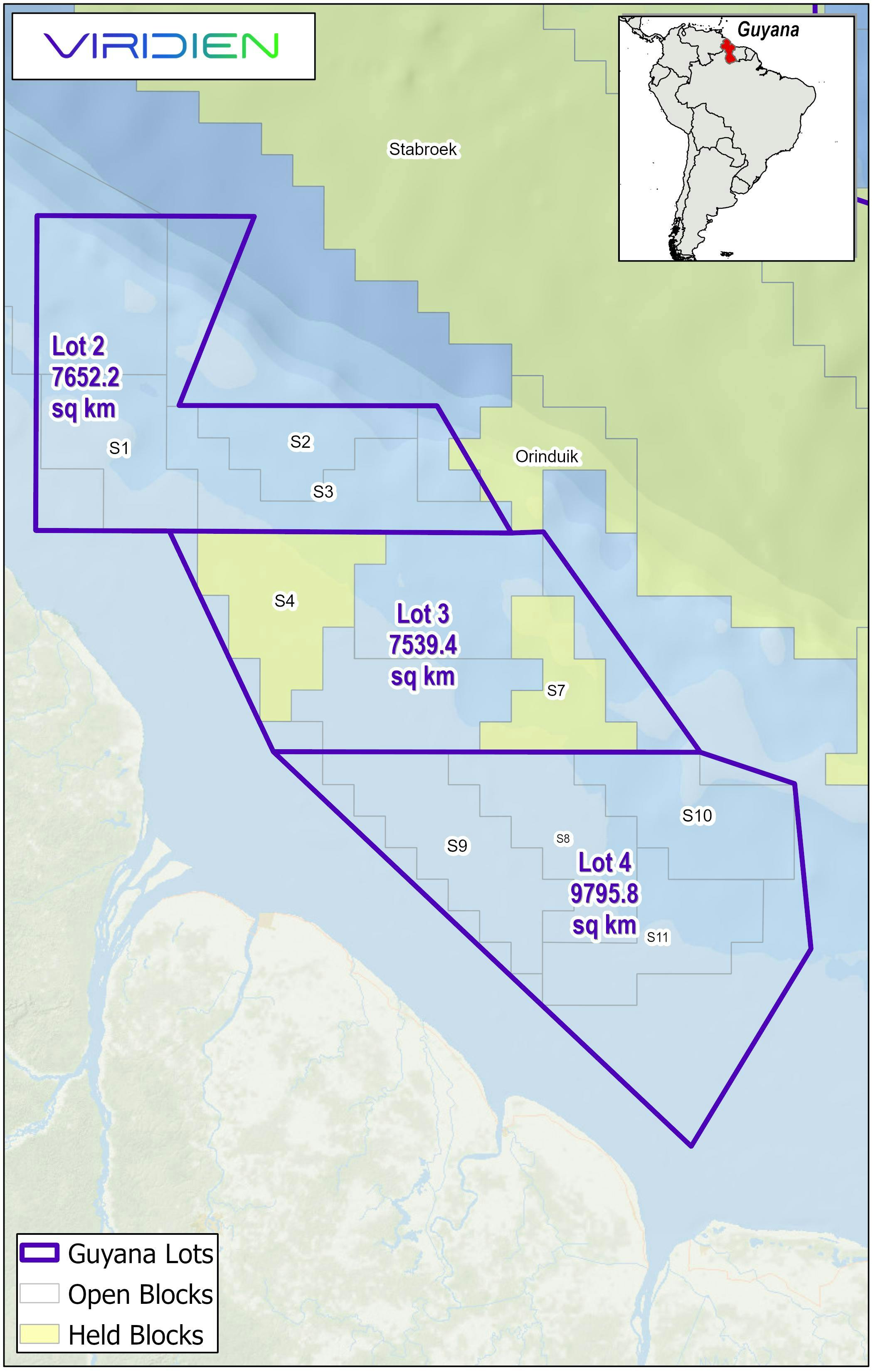
In South America, Viridien and BGP have an agreement with the Ministry of Natural Resources of the Cooperative Republic of Guyana for a large-scale multi-client 3D seismic acquisition and imaging program across shallow-water acreage lots 2, 3 and 4, covering a total area of about 25,000 sq km.
BGP will acquire the data with Viridien performing the imaging using its proprietary workflows such as shallow-water demultiple and TLFWI.
The ensuing new subsurface images and the re-imaged existing seismic will be available to support a future offshore licensing round in the area.
About the Author

Jeremy Beckman
Staff Writer / Editor, Europe
Jeremy Beckman has been Editor Europe, Offshore since 1992. Prior to joining Offshore he was a freelance journalist for eight years, working for a variety of electronics, computing and scientific journals in the UK. He regularly writes news columns on trends and events both in the NW Europe offshore region and globally. He also writes features on developments and technology in exploration and production.