TGS details goals of latest seismic surveys
Offshore staff
OSLO, Norway – TGS has issued updates on its current offshore seismic surveys in its latest results statement.
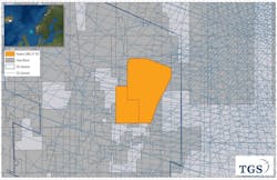
In mid-August, a new ocean bottom node (OBN) survey started over open and held acreage in the NOAKA area of the Norwegian North Sea, between the Oseberg and Alvheim field centers.
There has been active Infrastructure-Led Exploration (ILX) activity over the region in recent years and the area covered includes the 500-MMboe NOAKA multi-field development.
In the Sarawak basin offshore Malaysia, a 6,400-sq km (2,471-sq mi) multi-client 3D survey, in partnership with PGS and Schlumberger, is due to start shortly.
The BGP Pioneer has started a new 2D survey over the MSGBC basin offshore Mauritania. NWAAM 2021 will comprise 7,500 km (4,660 mi) of seismic data, with a modern broadband acquisition set-up.
Off Brazil, TGS continues acquisition on the Santos multi-client 3D Phase 4 survey in the western part of the Santos basin, designed as a northwest extension of the existing TGS Santos 3D.
Also progressing is the Pelotas 2D Phase 3 in Brazil’s Pelotas basin, an extension of the existing TGS Pelotas 2D data. Finally, in the US Gulf of Mexico, final products are available for TGS’ Declaration Refocus dataset, designed to support exploration and development planning.
During 3Q TGS’ Interpretive Products division finalized delivery of the Mexico Facies Map Browser (FMB) to the CNH (Mexican authority). Also, the North West Europe FMB 2021 should be delivered by the end of 1Q 2022, providing insights to support conventional oil and gas exploration and regional carbon storage assessment offshore the UK and Norway.
10/28/2021
