Ireland invites bids for frontier Atlantic waters
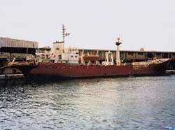
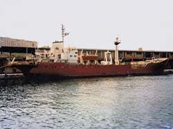
Ocean Surveyor, the vehicle for a bathymetric survey of the entire Irish continental margin.
Exploration off Ireland is taking a pronounced shift toward the deepwater Atlantic provinces. A new drilling campaign is under way in the Slyne Trough, and numerous seismic surveys are being staged in the Porcupine Basin and Rockall Trough.
The latter area was recently opened for licensing by the Irish government following the UK's decision to open up acreage on its side of Rockall. Both parties aim to capitalize on interest generated by the West of Shetland discoveries to the north which are on trend with these basins.
Bidders have until March 26 next year to apply for 615 full and 35 part blocks in the Irish Rockall Trough, which constitute the country's third frontier licensing round. Acreage offered covers 150,000 sq km of an area where, to date, just one well has been drilled.
Two areas of the Trough have been apportioned, with differing application terms. License bids in Area A (closer to western Ireland) must be for contiguous zones comprising not more than two and not less than eight full blocks. In Area B, in the northwestern part of the Trough, a minimum bid of four and a maximum of 12 blocks has been stipulated.
Licenses should be awarded by June 1997. These will be valid for up to 16 years with seismic exploration, but not drilling, mandatory in the first four years. Applicants are likely to include the main players in the Porcupine Basin and the Slyne/Erris troughs to the south and east. Mobil, Statoil and Enterprise have a professed interest in strengthening their position along the entire Atlantic Margin.
Rockall Trough is a southwest-northwest trending basin which has evolved since the Mesozoic, roughly 1,000 km long and varying in width from 250-300 km. Late Carboniferous to Tertiary sediments up to six km thick are thought to be present.
Stratigraphy assessment has been hampered by paucity of well data and inconclusive old seismic, which did not penetrate a large, thick Tertiary igneous sequence. However, according to UK analysts Wood Mackenzie, more recent seismic exploration, combined with results from exploration in adjacent basins, has identified prospective areas at the basin's margin.
Suspected plays include structural and stratigraphic traps within fault blocks and submarine fans, and possible Permo-Triassic to Tertiary sandstone reservoirs capped by frequent shales.
Tilted fault block structures have been identified at the Trough's margins, where water depths are also shallowest - 500 meters compared with over 2,500 meters in the center of the Trough. Wood Mackenzie expects activity to focus on the eastern margin closer to Ireland, with fewer operators keen to work 360 km offshore in the western margin for logistical reasons.
Current west-facing exploration drilling is led by Enterprise Oil, which recently began a back-to-back program in the Slyne Trough as part of a deepwater license commitment. Vertical well 27/5-1 was abandoned, following minor oil shows in the Jurassic; the semisub Petrolia then moved north to spud wildcat Corrib North.
Enterprise, which is Ireland's largest acreage holder with 24 operated offshore blocks, plans further wells in the Atlantic in 1997-98. Marathon is also thought to be lining up a deepwater Irish well, and Total is also in the frame. Other license holders, however, may prefer to analyse the results of these wells and the swelling Irish seismic databank before committing themselves to drill.
Among the geophysical projects completed or in progress off western Ireland this year:
- GeoVentures of Bedford, UK chartered the MV Professor Polshikov to acquire 4,000 line km of 2D seismic over the south-east margin of the Rockall Trough.
- Geco Prakla has been shooting 2,000 line km of 2D spec seismic in Rockall with the Akademik Shatskiya.
- Spectrum is compiling 8,300 line km over the Irish western shelf margin, Rockall Trough and the Porcupine Basin
- Geco Rho collected 2,500 km of 2D seismic for Statoil in the Erris Slyne Basin, and has a further contract for Statoil in the Porcupine Basin. CGG, Digicon, and PGS Nopec may also be trawling western Irish waters at this moment.
Other surveys swelling the Atlantic Margin database include a bathymetric survey of the entire Irish Continental Margin by Geoteam-Wimpol. Around 300,000 sq km are being surveyed over depths ranging from 500 to 4,800 meters, using the vessel Ocean Surveyor, with Simrad and Geopulse providing respectively swathe bathymetry and sub-bottom profiling equipment.
Smith Rea Energy Analysts and Robertson Research International, both based in the UK, have also published comprehensive assessments of the Rockall Trough's hydrocarbon potential based on all known geological and geophysical data.
Recent exploratory drilling in the better known Celtic Sea and St George's Channel off southern Ireland has proven disappointing, with only a small gas discovery reported by Marathon. This was on the southwest lobe of the Kinsale gasfields, and will eventually be developed as a subsea tieback.
Marathon's Kinsale Head/Ballycotton gasfields supply Ireland's only indigenous offshore gas, but reserves are expected to deplete by 2003. At the same time, the nation's gas demand is growing at 6% per annum. Despite the installation of an interconnector pipeline from the UK west coast, Ireland's government would prefer to avoid reliance on gas imports: however, most of the new plays being targeted in the Atlantic Margin are expected to be oil-related.
Copyright 1996 Offshore. All Rights Reserved.

