Geosciences
Gene Kliewer • Houston
Statoil contracts major 3D seismic project offshore Alaska
Fugro-Geoteam has agreed with Statoil USA E&P Inc. to acquire and QC process data from a 2,400 sq km (924 sq mi) 3D marine seismic program around Statoil’s leases in the Chukchi Sea. The project is valued at approximately $26 million (€17 million), with an estimated duration up to three months. The survey is planned for early August into October 2010.
In consideration of the challenging conditions of the Chukchi Sea, combined with the limited acquisition window, Fugro-Geoteam and Statoil have agreed to use one of the world’s newest and technologically advanced, “C-class” vessels with a DNV ICE classification as well as the ability to tow an exceptionally high streamer count. The combination of which, will provide the capability to optimize production during the limited window.
New Zealand offers new tracts in Northland basin
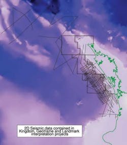
Nearly 50,000 sq km (19,305sq mi) of the Northland basin offshore New Zealand is offered by Crown Minerals in six blocks, three on the immediate shelf and three in intermediate to deepwater. The basin consists of a sedimentary sequence up to 9 km (5.6 mi) thick, resulting from a multi-phase series of tectono-stratigraphic events, according to Crown Minerals. This sequence is similar to the Taranaki basin and onshore Northland geology, but is underlain by the Jurassic sequences identified in Waka Nui-1.
A supplementary data pack is available for the offer. The data was acquired in March 2009 by CGGVeritas as part of a seismic survey over the Reinga basin, which is contiguous to the Northland basin. The data pack contains the Crown owned lines (REI09 12, 20, 28, and STRANSSP 205 and 306).
The offshore Northland basin is west of the upper part of the North Island of New Zealand and is contiguous with the hydrocarbon producing Taranaki basin. Over the last three decades, the region has seen extensive seismic survey coverage and the drilling of two wells in the area. The Waka Nui-1 well changed the understanding of the sequences of the region with Jurassic sediments being intersected, while the Karewa-1 well intersected significant, but as yet non-commercial, biogenic methane in the Neogene sediments. Satellite radar imaging recently highlighted a number of potential offshore oil seeps.
Active exploration is under way in the permitted southern segment of the basin by a consortium of Origin and OMV, who have recently carried out new 2D and 3D seismic surveys. This area links to the northern part of the Taranaki basin with similar sequences.
Potential source rocks exist in the Jurassic coaly sediments of the Murihiku Supergroup, Early Cretaceous Taniwha formation coaly sediments, Late Cretaceous coals of the Rakopi and North Cape formations, and marine shales of the Paleocene Turi and Waipawa formations. Modeling of just two sources over the basin suggest potential oil and gas in a 100-m (328-ft) thick basal section of the Taniwha formation in addition to reserves in a 50-m (164-ft) thick Waipawa formation which is just reaching the expulsion threshold.
Numerous potential reservoir facies include transgressive coastal sands and conglomerates of Cretaceous and Paleogene ages, and turbidite sands of Neogene age.
A number of structural and stratigraphic traps are recognized from the seismic interpretations recently undertaken and are included with this data package.
BP contracts LoFS studies for the North Sea
Stingray Geophysical Ltd will conduct two Life of Field Seismic (LoFS) feasibility studies for BP. The studies will identify the requirements for an integrated approach to LoFS or Permanent Reservoir Monitoring (PRM) on the Clair and Schiehallion fields, operated by BP in the UK North Sea.
The first study focuses on the installing LoFS solutions on the Clair field. The second study will evaluate the impediments and risks associated with cost-effective LoFS solutions for the Schiehallion field on the Atlantic margin. The field is produced through subsea completions to an FPSO, resulting in an obstructed and changing seabed environment which presents new challenges for the installation of PRM systems.
“We are delighted to be pooling our collective knowledge and experience with BP to address the issues surrounding cost-effective and successful LoFS projects,” says Martin Bett, Stingray’s CEO. “Stingray has adopted a full life-cycle approach to reservoir monitoring and has been working on novel installation methods for its Fosar seismic PRM solution for some time. The most effective project approaches will understand the interdependencies and opportunities provided by taking an integrated approach to the supply of equipment and its installation.”
EMGS agreement with Rocksource
Electromagnetic Geoservices ASA (EMGS) has entered into a data-licensing agreement with Rocksource, in which Rocksource pre-committed to license newly acquired Clearplay Test EM data over a number of prospects in the Gulf of Mexico. EMGS and Rocksource are evaluating additional prospects to extend the program, including additional new acquisition as well as late sales of existing data library.
This new program to de-risk prospects in the Gulf of Mexico is an extension of the pre-existing relationships between FOCUS Exploration, Rocksource, and EMGS.


