Multi-client marine gravity gradiometry data acquisition grows
Phill Houghton
ARKeX
Few exploration technologies have moved as quickly up the value chain over the last few years as full tensor gravity gradiometry (FTG). The technique maps small density variations in the underlying rocks by measuring the gradient of the Earth's gravity field.
Gravity gradiometry first became commercialized in the early 1990s in the Gulf of Mexico and other marine environments where there were specific exploration challenges associated with salt tectonics. Often, however, it was viewed as a niche technology and took several years before moving away from the marine environment and into onshore exploration using aircraft.
Today, FTG is valuable in a variety of geologic settings and not just salt mapping. With explored areas of the world such as the Arctic, offshore Brazil, Barents Sea, and East Africa, there is a need for technologies that can provide valuable geologic information to augment seismic data and to help explorationists plan strategies. With the ability to cover relatively large areas quickly and to complement information from regional 2D seismic programs, FTG is again becoming an offshore exploration tool.
FTG in marine environments
There are a number of reasons why FTG is appropriate to offshore exploration today.
First, the high-resolution data and bandwidth are significant improvements over conventional dynamic gravity measurements. Secondly, the 3D nature of full tensor gradiometry provides additional structural information offline. These benefits, coupled with a strong signal-to-noise ratio, make marine FTG effective in modeling complex offshore geologies.
In subsalt areas – like offshore Brazil, the Gulf of Mexico, and offshore West Africa – the relatively low density of salt compared with typical host material and the typical morphology of salt bodies, present ideal targets for high-resolution FTG rather than challenges to success.
In such cases, FTG can map the density contrast between salt and the surrounding sediments, and the precision of the FTG models, together with pre-stack depth migration (PDSM) seismic data, can lead to effective and actionable velocity/density relationships. This is particularly applicable where seismic data is sparse, and is useful early in the exploration lifecycle.
FTG can play a key role offshore by taking the interpreter outside the narrow plane of 2D seismic acquisition and providing increased spatial awareness of the target area within a 3D environment.
FTG can provide data to intelligently interpolate between two seismic lines, often several miles apart, can connect independently interpreted faults, and often can incorporate much needed 3D geology into the data sets. The result is a much more constrained and accurate 3D earth model on which important decisions about leases, additional data acquisition, and possibly drilling can be made.
Furthermore, as density is the material property controlling the gravity field, and seismic events are controlled by impedance contrast, the combined result is a direct link through the material property between the earth models which are compatible with both seismic and gravity gradient data.
By interpreting with both measurements in view, operators can better constrain the velocity/density relationship through a more compatible measurement scale and reduce uncertainty in velocity structure on a seismic scale, thereby strengthening the earth model and subsequent velocity model.
Finally, FTG efficiently and cost effectively acquires marine data covering vast regions with little to no environmental impact. The data generated can influence the cost effectiveness of future marine seismic surveys, such as wide-azimuth (WAZ) surveys where as many as four vessels might be used. Pinpointing the areas to target through marine FTG can result in significant cost savings.
Case histories
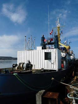
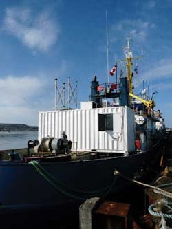
ARKeX recently completed a marine FTG survey in the Red Sea in three blocks off the western coast of Saudi Arabia. The survey objective was to improve the definition of the top and flanks of salt bodies within the survey area. The FTG data was used to enhance geological and velocity model building, and to improve overall 3D seismic imaging.
Other examples include a marine FTG survey offshore Guinea Bissau for Svenska Petroleum Exploration and a survey off the western coast of Greenland for Cairn Energy.
The Guinea Bissau survey aimed to give Svenska a better understanding of the extent and shape of the salt in the vicinity of the Sinapa discovery, and to better define a number of leads, prospects, and discoveries at various stratigraphic intervals.
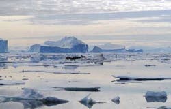
In the Arctic, Greenland also offers huge potential for FTG. The US Geological Survey (USGS) said, "The extensive Arctic continental shelf may constitute the geographically largest unexplored prospective area for petroleum remaining on Earth."
By adopting FTG, operators can quickly and non-invasively assess the petroleum geology of the area with the aim of de-risking future exploration.
In all three cases, FTG data is included as a main element of the initial exploration strategy. In the case of Svenska and Saudi Aramco, FTG took place alongside 3D seismic surveys, with the seismic and FTG data combined to constrain the extent of the salt and to de-risk future exploration within the blocks.
Move toward multi-client data
In addition to providing specific surveys for operators on a proprietary basis, ARKeX is adapting to acquire multi-client FTG data. This will help take advantage of economies of scale in the industry by spreading the acquisition and processing costs among multiple customers without operators having to stretch in-house resources and exploration timelines.
For the operator, it means high-quality data at the fraction of the cost of exclusive proprietary ownership, a deeper 3D geological insight, higher exploration success rates, and a ramping up of operator knowledge when targeting a specific area. For host governments, it means lower entry costs, more competitive licensing rounds, and more efficient and profitable resource development.
The multi-client approach is valuable to smaller independents that lack the financial and specialist resources to efficiently leverage everything that non-seismic data can deliver. Current offshore plays of particular interest to the smaller independents include the Tano basin in Ghana, some of the more mature areas of the North Sea, offshore plays west of Prudhoe Bay in Alaska, and new plays in West Africa, such as offshore Gambia and Guinea-Bissau.
ARKeX recently won the rights from the Mozambique government's National Petroleum Institute to acquire FTG data in Mozambique. Three areas have been identified, two onshore (the Maniamba basin in the North Western Niassa province and the Southern Mozambique basin) plus one offshore area around the Beira High.
The resulting data will be crucial in developing what still is considered a frontier region. Currently, operators Total, Anadarko, and Eni are targeting offshore Mozambique. In February 2012, Eni made a natural gas discovery at the Mamba North 1 prospect in Area 4, offshore of Mozambique. The company estimates that the total volume of gas in place in the Mamba complex is about 850 bcm (30 tcf).
Another multi-client FTG survey is scheduled for offshore northeast Greenland. The proposed survey, in partnership with a seismic company, will provide information about the area as part of the 2012 and 2013 licensing rounds.
De-risking tool
Whether applied to licensing, frontier exploration, mature plays, prospect generation or prospect evaluation, FTG is a powerful de-risking tool and a source of crucial information for future 3D marine seismic surveys.
With more multi-client data acquisition and added value to existing 2D seismic coverage, FTG should grow, optimizing the design and acquisition of seismic surveys, optimizing earth models, addressing illumination problems, and reducing risks and costs.
Offshore Articles Archives
View Oil and Gas Articles on PennEnergy.com