Eastern Mediterranean Tamar discovery reveals potential gas-rich play in Levantine basin
Jeremy Beckman - Editor, Europe
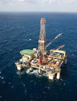
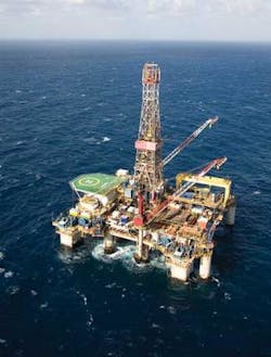
Test results from a gas discovery in the Levantine basin point to an emerging subsalt play. The deepwater well on the Tamar structure, 90 km (56 mi) offshore Haifa, Israel, encountered three productive reservoirs with thick sands in the Lower Miocene and net pay of more than 460 ft (140 m).
Gas flowed at a constrained rate of 30 MMcf/d over a limited section of the lowest reservoir, and operator Noble Energy believes a production rate of over 150 MMcf/d could be feasible. It claimed the find could be the largest in its history, with a resource potential of around 5 tcf. The water depth of 5,500 ft (1,680 m) was also the deepest by far for any well to date in Israeli waters.
Noble and its partners are set to retain the rig, theAtwood Hunter, for two more wells. The first would be on Dalit, another Tertiary/Lower Miocene subsalt prospect in 4,500 ft (1,372 m) of water in the Michal permit, 28 mi (45 km) offshore, which is already covered by 3D seismic. The second well would be a step-out on Tamar, in the Matan license.
Further gas finds would help ease Israel’s energy concerns. The country’s sole production comes from the Mari-B field in shallow water off the southern coast. The Gaza Marine discovery has yet to be put into production. Otherwise, the only external source of gas is a pipeline from Egypt, but throughput has been subject to interruptions.
In recent years, Houston-based Noble and local company Delek Drilling have been the mainstays of Israeli E&P. Prior to Tamar, there had been no exploration drilling for several years, but more recently other companies have picked up offshore concessions. These include Israeli junior PetroMed, which last year converted two deepwater exploration permits in the Levantine basin to drilling licenses (Sara and Myra) both a short distance from the Matan license. The company also operates an adjoining exploration permit (Benjamin).
PetroMed’s interpretive studies of existing geological and seismic data since 2005 indicated strong potential for thermogenic gas, and for condensate and oil at deeper levels. The company’s acreage is close to the Tamar discovery and on trend with the Dalit structure. PetroMed also has found strong indications of deeper lying, light Jurassic oil, based on wells closer to the Israeli coast and via geological analogies with recent ultradeep discoveries in the Nile Delta to the south.
Hibernia ‘look-a-like’
The company describes its mission as “to discover, drill, develop, and deliver oil and gas to Israel,” with a focus on offshore targets. It was formed in 1999, originally as a Nevada-based corporation, by financial and management consultant Hagai Amir. Four years later in Calgary, he and Russell Koch were introduced to the late Donald Axford, a Canadian geologist credited with finding the Hibernia field off Newfoundland.
Axford believed he had “seen” another Hibernia on seismic offshore Israel.
AJ Amir is chairman and CEO of PetroMed, supported by finance director Koch, who is based in Seattle. Other board members include Arlon Tussing, a former chief energy adviser to the US Senate and now energy consultant for the World Bank and Deutsche Bank.
The company’s exploration team of experienced geologists and geophysicists, all based in the UK, are headed by exploration manager David Peace. The team is complemented by external consultants RPS, providing assistance with 3D survey design and specialized data reprocessing, and Aberdeen-based contractors to help with early well planning.
For much of his exploration career Peace has worked in the greater Mediterranean region. He worked in Milan for Agip and Penn Geophysical, and headed an interpretation team of eight geologists and geophysicists for Agip reviewing much of the Italian offshore region and the Po Valley. In the 1990s, he was Texaco’s exploration manager, based in Rome, and a director of Texaco Italiana Spa.
After leaving Texaco in 1998, Peace was an independent exploration consultant and conducted a regional evaluation of the entire Eastern Mediterranean based on Spectrum’s regional seismic grid of 25,000 line km (15,534 mi).
“Spectrum had a regional seismic grid around Cyprus and Lebanon,” he explains, “based on a reprocessed speculative survey originally acquired in 1975. This data was a wide-spaced regional survey from southern Turkey to the eastern Nile Delta, and covered the thrust zone between Anatolia and North Africa – one of the major continental margins – and it revealed a very attractive new play.
“The old data had imaged the entire Levantine basin, which had not really been explored by any of the countries in the region. Due to recording limitations, they had only recorded the first five to six seconds of data – hence also seeing only the top of the basin. However, when Spectrum acquired its 20,000 km (12,427 mi) of new seismic in 2001-2002, it recorded down to 12 seconds, which allowed us to see the deeper part of the basin.”
The only prior wells in the area were off southern Turkey and had led to some small discoveries in the Iskendrun basin. Spectrum’s new seismic provided a more detailed 2D grid over offshore southern Turkey, Syria, Lebanon, Cyprus, Israel, Gaza, and the outer fringes of Egypt, and was designed to promote licensing rounds in these countries.
In 2001, when the surveys were being acquired, the Lebanese government was in talks about a first offshore round, but this never came about at the time. Cyprus also considered staging a round, although this did not take place until 2007-08.
“To date,” Peace adds, “there has been no offshore drilling either in Syria or Cyprus, and only one well offshore Lebanon. Onshore Cyprus, which is the epicenter of the collision zone with Africa, is one of the toughest to interpret geologically in the world, but we see the sedimentary plays on the fringes of the Levantine basin as very interesting.”
In late 2002, Peace began evaluating Spectrum’s entire database for the eastern Mediterranean region, concluding the program in fall 2003. The results looked very promising: “In the Levantine basin, including the Latakia thrust zone in the north, we identified some very interesting structural patterns which showed a lot of individual seismic leads, from small closures to much larger simple structural traps.”
Southerly analogy
To the south in the Nile Delta, exploratory drilling began in earnest in the late 1990s. “British Gas started finding gas in channel sands in the shallow Pliocene section above the deeper Messinian salt layer that covers much of the Mediterranean,” says Peace. “Later, they followed similar channel features up the eastern Mediterranean coast to make further biogenic gas finds off Gaza and southern Israel.
“At that time I was with Texaco and to us, the whole area looked rather gas-prone in the early days. Later on, however, the focus of Nile Delta exploration switched to drilling through the Messinian salt zone, and over the last few years companies have found not just biogenic gas of shallow origin, but also deeper thermogenic gas and, more recently, condensate and oil 4.5 km (2.8 mi) down in the high-pressure/high-temperature zone. So the message is clear: biogenic gas in the shallow section, but thermogenic gas, condensate and free oil in the deeper pre-salt section, a situation we believe exists in the Levantine basin as well.
“From our evaluation of the Spectrum regional data, we can see that the Levantine basin has some characteristics and geological conditions similar to the Nile Delta (although not at all identical) and which extend into PetroMed’s licenses. Inshore from our blocks, two older wells have already tested 800 b/d of light ‘Jurassic’ oil from deeper lying Jurassic strata underlying our permits. These excellent oil shows are almost certainly the result of migration from the deeper parts of the basin to the west, and provide further evidence for an active thermogenic hydrocarbon system in the deeper part of the Levantine basin, in part mirroring what we see off Egypt.”
Exploratory leads
Following initial contact and dialogue with the Geophysical Institute of Israel near Tel Aviv, PetroMed submitted its initial technical presentations for its permit areas to the Ministry for National Infrastructure in Jerusalem early in 2006, and these were granted later that year. Initial evaluations continued to confirm the potential of the areas, and last year the company opted to convert the permits to three-year drilling licenses.
The Sara and Myra licenses both cover 400 sq km (154 sq mi). Peace and his team so far have identified two large prospective lead areas, one in each license, in water depths of around 1,100 m (3,609 ft). One is a thick four-way dip closure from Tertiary to Jurassic, which is on trend with the Dalit structure in the adjacent Noble-operated permit. The second prospect is a potential reef growth on top of an older high, which is in turn overlain by potential Cretaceous and Tertiary reservoirs, as confirmed in Tamar.
The company has a letter of agreement for a 3D seismic vessel, and aims to start acquiring 3D over the two license areas by mid-year, followed by detailed processing and pre-stacked depth migration of the data.
“We will do the interpretation ourselves,” Peace says. “We’re happy that the structures are there from the 2D data, so the main purpose of the 3D seismic is to confirm internal geological detail within each of the structures to allow us to optimize future drilling locations.
“We need 3D data primarily to define these structures in greater detail – we can see anomalies within them that cannot be resolved by 2D seismic. Thereafter, we plan to select our best drilling locations and be ready to spud our first well within two and a half years from now. At the same time, it is also a case of getting partners on board to share the well costs.”
According to Hagai Amir, PetroMed has been in open dialogue with several major oil companies in this regard. “At this time,” he says, “we are open to offers from potential new financial partners and strategic partners from the industry. Ideally, the partner we would prefer would be an established international oil and gas company with significant drilling and operational experience.
“PetroMed is currently operator of all three licenses and permits for all technical work up to the initial well spud, but we would welcome specialized geophysical technical assistance from suitably experienced new partners as well. As we are only a small company, we would also prefer that a more experienced oil company partner would operate as we enter the actual drilling phase.”
Water depths in the two drilling permits extend to 1,500 m (4,921 ft). Both carry initial three-year terms, but in the event of a discovery, these can be renewed for a further four years for appraisal drilling, and 25 years for subsequent development and production. The work obligations for the adjoining, 18-month exploration permit include geological studies and 2D seismic.
“Our long-term ambition,” says Amir, “is to build a stronger and stronger exploration position, work up opportunities that will attract further industry partners, and see them developed while retaining an interest therein. In time the company may also consider venturing outside Israel to explore other opportunities, but the recent discovery of Tamar has confirmed our belief in the region, and we are very happy with our current acreage.”

