M-WAZ survey data unlocks Mississippi Canyon subsalt plays
Duncan Bate • Daniel Chaikin • Henrik Roende • Jason Kegel
TGS
The eastern Mississippi Canyon has proven to be a highly prospective area in the US Gulf of Mexico for many years. It remains a core area for subsalt exploration, and there currently is a high level of activity in the area despite the considerable water depth and low oil prices. The complexity of the salt consists of multiple forms, from multiple layered salt to steeply dipping diapers or thick sheets. This area has some of the most dramatic and difficult to image salt formations in the world.
The Gulf of Mexico has driven many aspects in the development of seismic technology and subsalt imaging. From 2D to 3D and from narrow-azimuth (NAZ) to wide-azimuth (WAZ) acquisition technologies the subsalt image has been refined through time and an ever-improving set of imaging tools have been developed.
The Declaration 3D WAZ survey covers 8,885 sq km (3,430 sq mi) in the Mississippi Canyon and Viosca Knoll protraction areas of the central Gulf of Mexico and was acquired orthogonal to TGS’ underlying Justice WAZ 3D survey. With offsets to 16 km (10 mi), this data was acquired to better image deep structural elements and to improve subsalt and salt flank illumination, which has established new standards in the region. The results were integrated with TGS’ existing Justice WAZ 3D data to provide orthogonal (or multi) wide-azimuth (M-WAZ) coverage over the area. In keeping with the company’s mandate to provide technical leadership through its data offerings, it has been processed using some of its advanced imaging technology including Clari-Fi, orthorhombic modeling, and common offset reverse time migration (RTM) gathers.
To develop seismic programs that meet industry demands for both today and tomorrow, TGS uses technology to optimize the acquisition and processing parameters. An illumination study on the complex Kepler salt of the Mississippi Canyon was used for this purpose, including 2D finite difference modeling of various cable lengths and a 3D ray-based illumination study with unrestricted offsets and azimuths. The conclusion and recommendation from this study was to acquire long offset and multi-azimuth data. With 16 km-long offsets and WAZ acquisition, the integration of existing Justice WAZ 3D and new acquisition, Declaration M-WAZ 3D meets the recommendation of the illumination study to ensure the optimal illumination of the complex geologies in this region.
The acquisition parameters are only part of the process. To obtain the required subsalt image, an optimal data processing flow is needed. Building on the previous imaging work done for the Justice data, the new flow includes a number of technologies that provide substantial uplift. The 3D deghosting (AWD Clari-Fi) improves the bandwidth of the image and minimizes the side lobes, providing an image that is closer to ideal geologic features. The acoustic interface is ideally a spike and not a wavelet. By using the multiple tables from several azimuths for surface related multiple elimination, more data and statistics can be applied to the 3D model for the removal of multiples. The interpretation of salt features does not have to start from scratch; the Justice model forms the starting point, just as it built on previous NAZ models. The time and effort during the model build for Declaration can be applied to refining the model. In previous iterations of multi-client WAZ imaging, the industry standard for the subsalt velocity model was often a simple depth varying function, because it is not possible to use conventional tomographic updates in subsalt. The use of common offset RTM (COR) gathers for subsalt velocity update in Declaration provides a greatly improved image and a closer tie to subsalt well data.
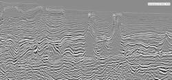
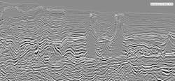
The Declaration 3D M-WAZ data provides an enhancement and redefinition of critical geologic features in the Miocene, Mesozoic, and presalt sections. Miocene sand reservoirs, such as those in Chevron’s Blind Faith development, are imaged in unprecedented detail. Fine details can now be observed and mapped. Stacked sand packages can be differentiated in places, thanks to the higher frequency used (up to 40 hz). These Miocene units can be mapped further and more accurately under salt and along salt flanks due to the significantly improved model building, subsalt imaging, and azimuthal coverage. Better geologic integrity in the model, including an updated salt interpretation and tomography that is able to more accurately account for details such as the Cotton Valley inversion, have led to significant enhancement of the Mesozoic section. The critical structures that define the prospects along the Norphlet trend, like Shell’s Appomattox and Fort Sumter projects, are imaged more accurately than ever. In some areas, the structures of the Mesozoic section that are typically washed out or had not previously been imaged clearly, are now revealed.
Declaration provides a new, or really a first look, at the presalt section in 3D in the region. This presalt imaging is permitted thanks to far offsets and the multiple direction WAZ coverage, and the image is enhanced with COR gather based tomography. The Declaration 3D M-WAZ survey will form the basis for exploration in this part of the Mississippi Canyon for many years to come.

