3D at Depth enters geophysical survey market
Offshore staff
LONGMONT, Colorado – 3D at Depth Inc. has launched an offshore Geophysical Survey Services division.
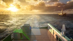
The new division will provide surveys to support both nearshore, inshore, and offshore deepwater development activities focused in the areas of offshore wind farms, pipeline routes, environmental site surveys, offshore hydrocarbon projects, and civil engineering surveys.
The company first commercialized Subsea LiDAR technology for the offshore industry in 2014.
The Geophysical Survey Services division will leverage the company’s in-house electronics, system integration, and design capabilities as key differentiators. Subsea LiDAR 3D data sets will be merged with multibeam echosounder multi-frequency, multi-spectral data acquisition and optical technologies.
The range of services includes: rig and platform site surveys; geohazard surveys; wind farm site surveys; pre-engineering surveys; clearance surveys including UXO; ice gouge surveys; multibeam echosounder surveys in shallow and deepwater; pre-and post-lay pipeline route surveys; deepwater sited developments; LNG and FPSO offloading facilities; and marine archaeology and cultural heritage sites.
02/23/2021