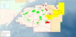
Gippsland basin survey extends 3D coverage to deeper water areas
Offshore staff
MASSY, France – CGG will soon deliver fast-track results from its recent 3D multi-client seismic survey over the Gippsland basin offshore southeast Australia.
The broadband data will be available to support bidders for blocks V20-3 and V20-4, which are offered under Australia’s 2020 Offshore Petroleum Exploration Acreage Release.
According to CGG, this was an industry-first, basin-wide survey covering an area of more than ~8,700 sq km (3,359 sq mi), and represents Phase II of the company’s Gippsland ReGeneration reprocessing and acquisition project.
Imaging the basin’s shelf break and numerous submarine channels is said to have been problematic in the past. Features of the new survey include high-resolution 3D seismic, a broadband, long-offset configuration with 3D joint source-receiver deghosting, high-frequency full-waveform inversion, and least-squares Q migration.
This combination, the company said, should provide clearer images of deeper targets not visible in the legacy data, also extending seismic coverage to prospective deepwater areas that had no prior 3D data.
Sophie Zurquiyah, CEO of CGG, said: “The data from our new Gippsland 3D survey will complement and build on…our Phase 1 reprocessing of 11,500 sq km [4,440 sq mi] of legacy 3D seismic data with our latest imaging innovations, which led to a resurgence of interest in what was considered to be a mature basin in decline.”
09/22/2020