PGS extending Viking Graben seismic data coverage
Offshore staff
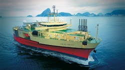
OSLO, Norway – PGS’ vessel Ramform Vanguard has started a new multi-azimuth marine seismic survey in the North Sea.
This industry-funded project extends the GeoStreamer X area within the Viking Graben by 1,160 sq km (448 sq mi). The first data is due in 3Q 2020.
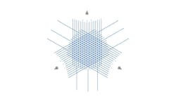
The GeoStreamer X Viking Graben 2020 extension project will again combine three acquisition directions with the company’s latest technology innovations for advanced offset- and azimuth-rich data. This project builds on the 2019 GeoStreamer X pilot project in the same area.
Gunhild Myhr, vice president New Ventures at PGS, said: “Our GeoStreamer X Viking Graben pilot clearly demonstrated the positive project economics and the illumination uplift that can be achieved with multi-azimuth GeoStreamer data on NCS. That is why, even in these difficult times, the market is willing to support an extension of the GeoStreamer X coverage area.”
According to the company, geological challenges in the Viking Graben area are illumination and resolution of potential targets in sand injectites, improved velocities prediction of V-brights, which cause shadow zones underneath, and improved imaging underneath the large, shallow channels.
The Ramform Vanguard will tow 14 streamers, including two 10-km (6.2-mi) long tails to provide offsets for FWI, and a wide-tow multisource with a 250 m (820 ft) total separation. This configuration will deliver close to zero offsets, for optimal near-offset sampling and shallow imaging, the company claimed.
05/12/2020