Geosciences
Victor Schmidt • Houston
Regional 3D returns
One of the weaknesses of current exploration practice is the reliance on "postage stamp" interpretation: imaging and interpreting relatively small areas with 3D seismic. For the Gulf of Mexico, this is represented by one-block interpretations – 3 x 3 mi. This "column" of acoustic data tells the interpreter much about the surveyed block, but the wider basin tectonics and petroleum kitchen information are not imaged, interpreted, or integrated into the project.
To add to the problem, many companies have eschewed micropaleontology. This blinds the geoscientist to the true time-stratigraphic location of anomalies because there are no vertical markers to identify where they lie within the time-stratigraphic column.
Sequence boundaries are time-stratigraphic, so it is important to know where the anomaly is when tying loops or "zapping" across amplitude surfaces. Machine interpretation cannot know which phase to follow when a horizon transitions, crosses a fault, or jumps a sediment boundary. These decisions require professional input.
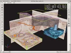
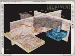
SGI extended the seismic imaging benchmark to 400 gigabytes, opening a path to easier regional interpretation.
Now there is an expanding capability to address part of this issue through clustered, scalable computer systems combined with standard graphic card technology. Silicon Graphics recently demonstrated the ability to access 400 Gb of data in a test with Marathon Oil's 3D data and Landmark Graphics' GeoProbe software.
This test extended the access benchmark four-fold from its earlier 100-Gb limit. Since most interpreters only access 32 Gb on average, this leap in capability allows the interpreter to examine complete mini-basins or larger regional 3D surveys.
"Because we are able to so dramatically increase the expert bandwidth with this interface, we are not only able to increase the volumes of information we can present but (also) the rate at which we can present new large volumes of information to the user," Bill Bartling, senior director of Market Strategy-Energy for SGI, says. "It gives every individual in the enterprise and in the network access to the capacity they need. They are not limited to the resources they have in their desktop system."
Shown at the recent Society for Exploration Geophysicists convention in Denver, Col-orado, SGI's prism visualization system is built around the Altix nodal computer to produce a single system image. It includes large processor counts, large memory, and a large number of ATI graphics cards. By linking the cards into a single cached memory, much more data can be imaged and quickly move, so that the regional patterns become evident. ;
EXPLORATION
Makassar Strait 2D
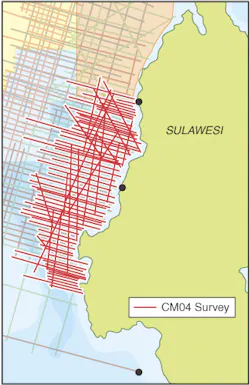
TGS-Nopec is shooting a non-exclusive 2D survey in Indonesia's Makassar Strait. The 5,200-km CM04 survey complements and infills earlier surveys. New data will be acquired over part of the West Sulawesi Fold Belt, an area likely to be offered in a 2005 bid round.
Compagnie Générale de Géophysique (CGG) was awarded a contract by ONGC for acquisition and onboard processing of marine surveys covering the west coast and a portion of the east coast of India. The $103-million project covers 19 separate surveys over 13,000 sq km. Vessels will tow 4-10 streamers and shoot from November 2004 to June 2005.
null
GoM 4C OBC
Terra Seismic Services deployed a four-component ocean bottom cable data acquisition system in the Gulf of Mexico. The system offers improved and automated in-sea system handling techniques for the VectorSeis Ocean recording and communication technology.
Madagascar survey
The Majunga Offshore Profond joint venture group is conducting a 3D seismic acquisition program over 3,657 sq km in the block's deepwater portion. The block covers about 4.4 million acres and is off northwestern Madagascar. The survey will image the Majunga salt basin.
According to Vanco, operator, the acquisition program is the first 3D seismic acquired in East Africa. PGS' M/V Ramform Challenger is acquired the data.
TECHNOLOGY P3
Veritas DGC launched P3, a new pore pressure prediction algorithm. The software uses seismic data to predict the spatial distribution of pore pressures between wells. The method was tested in the North Sea and offshore West Africa.
DCCOD
IBM opened its third Deep Computing Capacity on Demand (DCCOD) center in Houston, Texas. The DCCOD will run 512 IBM xSeries Xeon servers. Landmark Graphics (Halliburton) will be the anchor client for the Houston DCCOD and provide access to Landmark's Rapid Prospect Generation Engine.
DCCOD centers enable seismic processors to tap into supercomputing power to meet short-term needs with a pay-as-you-go model. Processors who have supercomputing capacity can supplement it to handle peak loads. The new DCCOD joins IBM's existing centers in Poughkeepsie, New York, and Montpellier, France.
