Offshore staff
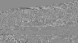
HOUSTON – TGS has started a 2D multi-client seismic survey offshore eastern Indonesia, just north of the Sunrise-Troubadour gas fields and west of the Abadi gas field.
The M/V Aquila Explorer is acquiring the 1,500-km (932-mi) survey, MHI11, designed to infill a previous survey from 2007 and an extensive multi-beam data set in the area.
TGS says the earlier survey revealed a series of undrilled fault blocks and horsts from the Permian up to the base Tertiary levels.
The current project seeks to provide a final detailed grid of data and to assist evaluation of the Sahul Platform and Timor Trough area, thought to hold an active petroleum system.
On completion of MHI11, TGS’ Indonesian library will include 120,000 km (75,564 mi) of 2D seismic, 3,500 sq km (1,351 sq mi) of 3D seismic, 400,000 km (248,648 mi) of multi-beam bathymetric data, and 1,200 core samples covering more than 1 million sq km (0.38-million sq mi) of Indonesia's deepwater basins.
TGS will make the processed data available to clients later this year.
09/26/2011