Al Hise
NCS SubSea
Jaime Stein
Geotrace Technologies Inc.
Detecting and analyzing the shallow geohazards in theGulf of Mexico has long been an industry-wide challenge. These hazards directly impact safety and the environment during drilling and completion. The economics of this impact are significant and cannot be ignored.
The high deposition rates in the Gulf of Mexico have created substantial drilling problems related to shallow water flow and high-pressure situations. New technologies and processes are being implemented that can mitigate risks associated with these and other near surface geohazards.
Whetherdrilling, building out subsea developments, or laying pipelines, mitigation of geohazard risks in the offshore production realm has long been a priority for operators. Knowing the extent of the geologic features just below the seabed is crucial to making informed decisions about where to conduct activities, and perhaps more importantly, where not to conduct activities.
Having the best information available and using it properly has been the modus operandi for the industry for decades. Among the difficulties are the quality and resolution of the available data. That data has often been ambiguous at best and unusable at worst. Failure to properly interpret and understand the near-seabed hazards can be costly, and sometimes with catastrophic results. Accurately imaging the hazards is necessary in order to effectively mitigate them.
Failed mitigation can lead to litigation, and this dynamic has been a reality for our industry for quite some time. Fuzzy information can lead to fuzzy decisions. The good news is that there are new tools that improve the fuzzy vision we are used to, bringing the hazards into much sharper focus to provide significantly improved assessments. NCS SubSea, Geotrace Technologies Inc., and Spec Partners have teamed to bring focus to the industry.
Historically, industry uses a single dataset or a combination of 2D high-resolution seismic data, long-offset 3D data reprocessed to high-resolution, and subbottom profiler data. None of these is sufficient to provide a very high-resolution image of the shallow structure beneath the seafloor. Variations in the resolution of datasets can be significant, and portions are always enigmatic, leaving the operator to make a decision based on insufficient information. As industry moves into deeper water, and much more complex geologic structures, the need to image these features accurately increases.

The resolution revolution
Enter the resolution revolution – ultra-high-resolution 3D seismic (UHR3D). The concept is not new, but the progression of the technology, and the ability to process and interpret the data, is now coming of age. Multi-streamer ultra-high-resolutionseismic acquisition has long been desired as it can provide true 3D meter-scale resolution of the near seabed geohazards, eliminating the fuzzy data and perhaps more importantly the fuzzy decisions.
Only in the past several years has this technology come to fruition in the form of the P-Cable. P-Cable AS of Norway, in conjunction with Geometrics, offers a very efficient and robust UHR3D system that allows for cost effective acquisition of data, with a larger footprint than standard 2D site surveys, and vastly improved resolution.
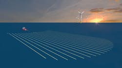
The P-cable system allows for up to 24 short, closely spaced streamers to be quickly and effectively deployed from smaller vessels, providing a cost effective way to collect useful, high quality, fuzz-free data. NCS SubSea has developed a multi-patented, precision, real-time navigation and binning system for the P-cable technology; and Geotrace has developed data processing tools to effectively process and render the data to its full level of resolution.
The key to achieving this vertical and spatial resolution comes from the design and configuration of the in-water spread. The P-cable is a powered cross member that allows for power and data transmission to and from the vessel. Data is handled via a high speed Ethernet link. The cross member can be configured with a streamer separation of either 12.5 m (41 ft) or 6.25 m (20.5 ft). Each take-out is designed to accommodate Geo Eel streamer sections of up to 300 m (984 ft) composite length.
In addition to a depth sensor, each junction box houses a high-precision, three-axis compass. The chosen geometry includes 18 x 100 m-long streamers with a group spacing of 6.25 m and a streamer separation of 12.5 m. This array provides a natural bin size of 6.25 x 3.125 m, yielding four-fold data at 12.5 m shot spacing. The system can record at 0.25 msec intervals and process at a lower sampling rate to achieve the ultra-high resolution image.
With additional compasses at the tail of each streamer, and DGPS near heads of the outside streamers and the source, the system can generate a very accurate real-time positioning. This allows for real-time binning and on-the-fly steering of coverage.
The essential technologies
In conjunction with Spec Partners, the group is conducting SAFE-BAND, a non-exclusive multi-client P-cable survey for the deepwater in the central Gulf of Mexico starting June 1, 2014. The program is not only revolutionary in its use of the P-cable technology in conjunction with custom positioning and processing tools by Geotrace Technologies Inc., it is the first time a UHR3D regional geohazard model is being offered. It seeks to advance the view of UHR3D and its applications for geohazard imaging, shallow reservoir imaging, and 4D reservoir monitoring.
The advanced processing techniques combined with proprietary technologies such as HDBand and the high-resolution imaging technologies should ensure a high-quality broadband product of unprecedented resolution.