Jo Firth - CGGVeritas
Arctic offshore exploration must be carried out in the short summer (July/August to September), while there is sufficient open water for towed-streamer deployment. Maximum efficiency is essential to make full use of the available acquisition time. Exploring this area responsibly requires specialized equipment and methods, deployed by exceptional crews working closely with local agencies, to meet the environmental challenges.
The biggest challenges to Arctic exploration are safety in the extreme conditions, the remote locations, and protection of the environment. To meet these challenges requires extensive and careful planning, covering not only the usual subjects such as spread configuration, geodesy, and resupply, but also contingency planning, HSE preparedness, and environmental and cultural sensitivity. Collaboration with local authorities and communities is essential to prevent impact on the environment and local subsistence lifestyles.
The remote locations mean supply lines are long, so fuel usually has to be ordered months in advance. Fresh food may only be available at irregular intervals, and there is limited access to spare parts. Small parts can be sent by air to the few coastal towns, but these are served by only light aircraft or helicopters, restricting cargo size and weight. The limited transport network means that crew changes sometimes use chartered aircraft rather than scheduled flights. Advanced planning for supplies and transport can maximize productivity during the available acquisition window.
Since 2008, CGGVeritas has recorded several High Arctic marine surveys, using three different vessels, including 23,500 km (14,602 mi) of exclusive and 9,600 km (5,965 mi) of multi-client 2D data, as well as 1,500 sq km (579 sq mi) of 3D data in the Beaufort Sea, the highest latitude 3D survey ever undertaken in the Western Hemisphere.
Safety equipment and training
Safety is always of prime importance. Standard training procedures are sufficient for most aspects of HSE (health, safety, environment) as CGGVeritas enforces environmental procedures and a strict “no spills” policy on all its vessels. However, additional measures are required to maintain the safety of the people and the ship when heading north. For example, cold weather training and adapted personal protective equipment is compulsory. Whenever possible, a Search and Rescue (SAR) helicopter is kept on standby, but for vessels in remote locations without a helideck, there is a doctor and “crash bag” on board, as well as the usual medic.
The principle hazard faced by arctic marine crews is ice. Chase boats are equipped with ice radar and dedicated ice pilots assimilate all the ice observations, ice radar signals, satellite imagery, and meteorological information to provide on-the-spot forecasts of ice conditions. The ice challenges vary throughout the Arctic; in Baffin Bay the main problem is drifting icebergs that are calved from the glaciers, whereas in the Beaufort Sea the primary problem is pack ice obstructing the survey area. Once the pack ice starts to break up with the onset of summer, it is essential to monitor ice floe movement in and around the work area.
Ice class vessels
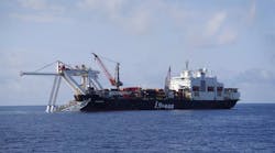
Arctic exploration requires Ice Class vessels. The hull must be thicker and; there must be several forms of rudder and propeller protection, and more watertight bulkheads than for normal class ships. In addition, heating for fuel, ballast, and other tanks vital to the ship’s operation may be required. CGGVeritas has six Ice Class vessels, including the newOceanic Vega, an Ulstein X-BOW vessel, launched at the beginning of July. The Vega’s DNV-CLEAN notation means there is no discharge of gas, oil, or any polluting agent and her “green passport” certifies that all materials and chemicals in the vessel are tracked from cradle to grave.
CGGVeritas’ Ice Class vessels have Sercel Sentinel solid streamers, which are preferred in environmentally sensitive areas due to their resilience to in-sea damage. In the sub-zero temperatures of the Arctic, the outer jacket of some streamers can shatter. Solid fill means that even if damage occurs, there is no leakage. Solid streamers have stable buoyancy and so provide increased depth stability in variable water temperatures and salinity, requiring minimal adjustment to ballasting which minimizes HSE exposure.
(Above) Freezing equipment is a constant challenge. (Below) In the Beaufort Sea the challenge is ice flow.
The extreme cold can also cause problems with the source, as the sub-zero temperatures cause the array to freeze into a solid block of ice when withdrawn from the water. Non-toxic antifreeze may be pumped into the guns to avoid this, but this year pressure steam washers have been installed to defrost the arrays. Experience in Arctic acquisition has led to many minor alterations to the vessels, such as the addition of curtains to the back deck to reduce wind-chill.
Wildlife protection
To protect the Arctic’s wildlife, Marine Mammal and Seabird Observers (MMSOs) monitor exclusion zones and record wildlife observations. Often, members of the local community are trained as MMSOs and ice monitors, thus providing local employment.
As part of wildlife protection, a new Passive Acoustic Monitoring (PAM) system was tested on one support vessel during last summer’s Beaufort Sea survey. Tests were performed to demonstrate the ability of a new generation of towed PAM system, based on vector sensor technology (triangulation based on a single towed array) to detect lower frequency cetacean calls (in particular Bowhead whales) in the presence of seismic signals. After the success of these experiments, CGGVeritas vessels now deploy PAM systems to listen for marine mammal vocalizations and complement the MMSO monitoring of the exclusion zone.
Source “soft-start” techniques warn marine mammals and polar bears of pending seismic operations and to allow time for those animals to leave the area. Offshore Greenland, the MMSOs map and count seabird sightings and transmit daily wildlife reports to the authorities. As survey areas may be adjacent to wildlife breeding areas, all vessels are fitted with an automatic GPS logging system operated by an independent company. The track plot of any vessel can be produced remotely by an impartial service provider, ensuring that all exclusion zones are honored.
Setting new standards
In the summer of 2009, CGGVeritas recorded a 3D survey in the Beaufort Sea, using theViking Vision vessel towing the largest areal spread (8 x 150 m x 7.2 km) (26.2 x 492 ft x 4.5 mi) ever deployed in the High Arctic. To manage the ice, the support vessels were equipped with radio links that let the Vision monitor their ice radar displays remotely. Ice reconnaissance flights gave additional information for ice forecasting. Accurate forecasts were necessary as the escape route from the enclosed Beaufort Sea to open waters was five days sailing from the survey area. It was essential that any de-mobilization decision be made early enough to leave before ice closed the Beaufort Sea for shipping until the next summer. Once full 3D streamer operations began, it was only necessary to leave the work area twice due to movement of pack ice. The survey acquired 1,576 sq km (608 sq mi) of high-quality 3D data, surpassing the most optimistic expectations for this survey. Another 1,488 km (925 mi) of 2D data were acquired while waiting for sufficient open water to deploy the 3D spread.
One part of the survey included water depths as shallow as 40 m (131 ft), posing a threat to conventional streamer lead-ins. To keep the spread from being too deep without exacerbating ice problems by adding extra floats, theVision crew designed and employed novel rigging techniques to solve the problem. The total technical downtime for the entire 55-day campaign was only 42 minutes, exceptional in the conditions.
Baffin Bay survey
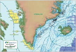
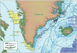
At the same time, another CGGVeritas vessel, theBergen Surveyor, recorded a 2D survey in Baffin Bay, offshore Greenland. Over 14,000 km (8,700 mi) of data was recorded, reaching as far north as latitude 74°. The crew won an industry HSE award for this and other surveys. Both the Bergen Surveyor and the Princess are shooting offshore Greenland again this summer.
Although many of the challenges in Baffin Bay are similar to those in the Beaufort Sea, the ice hazard is drifting icebergs rather than floe ice. As the bulk of an iceberg is below sea level, these drift according to deeper ocean currents, which may be different from surface currents and wind direction, making their paths difficult to predict. Where possible, lines were shot on the basis of their ice-free status, but ice movements often made this impossible. For the northern Greenland survey, lines were allowed to deviate around icebergs, whereas in southern Greenland the client requested that lines be stopped short when obstructed by icebergs and restarted later.
Due to careful planning, previous Arctic experience, and local knowledge, the Bergen Surveyor achieved productivity levels of over 150 km/day (93 mi/day) last summer. The main contributing factor to this was the use of a dedicated support vessel to do all re-supply, allowing theBergen Surveyor to stay on survey during the short operating season.
Once the data are recorded, the challenge shifts to the processing and imaging center, where expertise in handling the problems of ice-noise and advanced de-multiple and imaging techniques, etc. are needed to obtain reliable seismic images. Fasttrack products are done on board, so that if necessary the survey can be modified, based on real images to make maximum use of the short season.
Arctic to the Gulf of Mexico
Although conditions in different Arctic areas and the use of more ambitious spreads present new challenges, it is gratifying to see that the systems used in more routine work are applicable in the Arctic. In return, tools developed for use in the Arctic have been useful in other areas. For example, the success of the PAM system has led CGGVeritas to deploy these systems in other parts of the world, such as the Gulf of Mexico, and ice radar has proved to be useful for spotting long-line fishermen.
Acknowledgements
The author thanks the vessel managers and crews of the Vision, Bergen Surveyor, and Princess for their help in preparing this article.
Offshore Articles Archives
View Oil and Gas Articles on PennEnergy.com
