Alex Blacque, S. V. (Rao) Yalamanchili, Kenneth Mohn - Fugro
The integration of multiple data sets enables a more robust subsalt interpretation and provides a new method to predict structural traps that are cored by deep allochthonous salt in the deepwater Gulf of Mexico.

This type of study would be useful particularly in the US/Mexico cross-border region where fields such as Trident may straddle the dividing line. This work could indicate whether deep allochthonous salt mobilization has contributed to the formation of traps within the target Wilcox zone in Mexican waters, akin to those in US waters. It would also reduce the risk of high-grading false structures for drilling, a common problem in subsalt exploration.
Exploration in the deepwater US GoM has been the main offshore focus for the US petroleum industry since the 2001 discovery of thick Paleogene submarine turbidite sand in the Baha No. 2 well (Meyer et al. 2005). The presence of the Wilcox formation sands changed the perception of the industry to deepwater exploration and identified the presence of a new deepwater play – the “Lower Tertiary Wilcox Play.” Since this initial discovery, the play has extended from Alaminos Canyon east through Keathley Canyon to Walker Ridge on the US side and south into Mexican waters where Pemex expects to find similar stratigraphy in prospects such as Máximino-1 and Pep-1. Winker (2007) shows with 2D seismic data that the Wilcox sands extend into Mexican waters. His study, focused on the region outboard of salt in the abyssal plain, showed that the Lower Tertiary Wilcox Play may have thicknesses in the same range as the discoveries to the north in US waters.

Wilcox targets typically are three- or four-way structural closures obscured by a thick allochthonous salt canopy and cored by deep allochthonous salt. Outboard of salt, in Alaminos Canyon for example, these targets are four-way closures cored by deep allochthonous salt but without the masking allochthonous salt canopy. Traditionally, deep salt in the GoM has been referred to as autochthonous salt to distinguish it from the shallow canopy. However this terminology is misleading because “autochthonous” implies that no salt movement has occurred. The petroleum subsalt (canopy) Wilcox prospects do not have autochthonous salt beneath them but rather deep mobilized salt that contributes to the formation of the targeted structures. For this reason, the term “deep allochthonous salt” is used herein rather than “autochthonous salt.” The shallow salt canopy will be referred to simply as allochthonous salt or as the salt canopy.
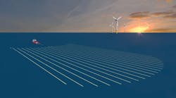
The challenge on both sides of the US/Mexico border is to image and to locate the Wilcox (and other) prospects adjacent to and below the salt canopy. An integrated approach to subsalt exploration was carried out by Fugro in 2007-2008 in US waters. The study used long-offset (10 km/6.2 mi) seismic data, high-resolution marine gravity data, and high-resolution airborne magnetics data over the Alaminos Canyon, Keathley Canyon, and Walker Ridge protraction areas, and also covered southern portions of Garden Banks and Green Canyon.

Understanding the play-fairway opportunities in this setting requires a regional, structural, and stratigraphic context for the Wilcox including subsalt sediment distribution and a better understanding of the tectonic framework of the basement. Mapping the structure of the rifted basement, its impact on sedimentation, the distribution of autochthonous salt, and the location of the continental-oceanic boundary (COB) all were crucial within the workflow, which culminated in a new deep allochthonous salt isopach used to confirm existing drilled structures and to identify new prospects within the subsalt environment.
This approach would allow companies such as Pemex to identify similar Mexican water prospects which cannot be imaged by seismic data alone.
The study had a number of additional key objectives to help reach the goal of subsalt prospect identification, including:
1. Delineation of an integrated basement surface across the area
2. Detailed filtering and qualitative analysis of the potential field data, independent of the modeling phases, to enhance the subsalt geology
3. Quantitative 2D and 3D earth modeling to help locate subsalt Wilcox prospects.
Workflow
Although gravity and magnetics have been used for many years to aid petroleum exploration, integrating seismic data has lead to a more robust workflow. This workflow has evolved to include prediction of both shallow allochthonous and deep allochthonous salt bodies, basement density and susceptibility, location of open salt feeders, and the position of the COB.

Crucial to this study is input data quality. For example, pre-stack depth migration (PSDM) seismic data is imperative to help the initial seismic interpretation. PSDM for the Deep Focus seismic project also used gravity data to guide the base allochthonous salt canopy interpretation. This integrated base of salt then was used to re-migrate the seismic data to produce better subsalt imaging of the top Wilcox, top Cretaceous, and acoustic basement. Datasets used included:
- 2 x 2 mi Fugro Multi Client Services Deep Focus 10 km long-offset PSDM seismic data
- 1 x 1 mi Fugro Gravity and Magnetics Services (FGMS) Integrated Deep Focus & Phase 45 marine gravity
- 1 x 1 mi FGMS high-resolution aeromagnetic data. This data includes approximately 3,000 mi acquired outboard of the Sigsbee Escarpment specifically for the project.
Existing FGMS and Integrated Geophysics Corp. (IGC) magnetic basement interpretation is a reference frame.
The final workflow contained the following steps:
- Interpretation of seismic horizons
- Computation of depth to magnetic basement using Werner deconvolution and other conventional depth solution methods
- Qualitative analysis of the potential field data, including residual grid generation by filtering without the influence of the allochthonous salt canopy
- Construction of the final integrated basement using elements of seismic acoustic basement and magnetic basement
- 2D gravity and magnetic modeling constrained with input from mapped seismic horizons, crustal thickness information, density/velocity data, and allochthonous salt distribution
- 3D gravity and magnetic earth modeling using all of the results obtained in previous phases. This final phase had two parts. The first part of the 3D modeling was to separate the deep allochthonous salt signal from the basement-related signal. The second part was to undertake a structural inversion to create a top deep allochthonous salt horizon. From these results it was possible to create the deep allochthonous salt isopach map.
Each stage in the workflow is a mini-project in its own right and a number of highlights are included from the various stages outlined above.

Gravity data: The new workflow allowed anomaly separation to distinguish basement and deep allochthonous salt anomalies during the 3D modeling process. Gravity inversion then was performed to predict the top of the deep allochthonous salt horizon. An isopach of this surface allowed identification of the deep allochthonous salt structures.
Magnetic data:The new integrated basement interpretation relied heavily on the seismic data outboard of salt where seismic imaging is best. The acoustic basement and magnetic basement are in agreement. However, at a few locations minor differences between these two basement surfaces were present. This area was called the calibration area and was used to compare the magnetic basement and acoustic basement without the influence of a salt canopy. This relationship in the calibration area enabled many of the magnetic anomalies to be traced back under salt where seismic imaging is more of a challenge.
Results
Enhanced delineation of basement structure has lead to a better understanding of the original salt depositional environment and rift morphology, which in turn has had a significant control on subsequent salt mobilization.
The work confirmed that basement structure is dominated by NW-SE and NE-SW trending lineaments/faults. Deep allochthonous salt mobilization is controlled by many of these features.
The location of the COB has been delineated across the region using evidence from all three datasets. Due to the extremely attenuated nature of the continental crust in the region (6-12 km, 3¾ - 7½ mi thickness across the study area), differentiation between what is oceanic and what is attenuated crust was a major challenge and can only be resolved by combining all three datasets.
Salt feeders (both open and closed) to the allochthonous salt canopy have been identified and the overall spatial distribution of deep allochthonous salt has been mapped.
Deep allochthonous salt structures have been predicted below approximately 90% of the drilled Wilcox wells in US waters (including dry holes) confirming that this predictive methodology works very effectively in the deepwater GoM.
References
Meyer, D., L. Zarra, D. Rains, B. Meltz and T. Hall, 2005, Emergence of the Lower Tertiary Wilcox Trend in the Deepwater Gulf of Mexico: World Oil, May 2005, p. 72-77 and Search and Discovery Article #10084, available online at http://www.searchanddiscovery.com/documents/2005/meyer/index.htm.
Winker, C. D., 2007, Paleogene stratigraphic revision and tectonic implications, Gulf of Mexico abyssal plain: GCSSEPM Foundation 27th Annual Bob F. Perkins Research Conference, p 376-398.
About the authors
Alex G Blacque, senior structural geologist, Fugro Gravity and Magnetic Services Inc. Education: B.Sc and Ph.D. in Geology from National University of Ireland at Cork.
S.V. (Rao) Yalamanchili, vice president of Interpretation, Fugro Gravity and Magnetic Services Inc. Education: B.Sc, M.Sc (Tech) and Ph. D in Geophysics from Andhra University, India, and a post graduate diploma in Mining Exploration Geophysics from ITC, Delft, the Netherlands
Kenneth W. Mohn, Exploration vice president, Fugro Multi Client Services Inc. Education: M. S. and B. S. degree in Geology from Stephen F. Austin State University.
Offshore US/Mexico border zone exploration: Cross-border perspectives
Robert Pawlowski (Chevron Energy Technology Co.), Ricardo Fernandez (Fugro Chance de Mexico) - Offshore Special Issue Contributing Editors
In the first article (July 2009) of our specialOffshore series pertaining to exploration of the US/Mexico maritime border zone, Javier H. Estrada (Analítica Energética S.C.) introduced some of the major legal and geopolitical issues facing development of cross-border oil fields. The geotechnical and engineering challenges to trans-border oilfield exploration and development are certainly no less difficult or imposing. Accordingly, this article in the series takes on a more geological and geophysical flavor, as Alex G. Blacque and co-authors (all of Fugro) share with Offshore readers the innovative, multi-disciplinary geophysical workflow developed by Fugro consultants for better assessing the regional, structural, and stratigraphic context of deepwater Lower Tertiary Play Wilcox prospects and geology. New geophysical data sets of increasing accuracy, precision, and resolution continue to be acquired in the Gulf of Mexico as an aid to hydrocarbon prospecting efforts. This article by Blacque and others showcases how a specially developed workflow can marry state-of-the art geophysical data to cutting-edge geologic thinking and concepts, capitalizing on the strengths of various data sets when used together so as to mitigate weaknesses inherent to individual data sets when the latter are used alone.