Gene Kliewer, Houston
OHM charters dedicated survey vessel
Offshore Hydrocarbon Mapping Plc. has chartered a dedicated CSEM vessel from Seatrans for five years. TheOHM Express is scheduled for a May 2007 launch.
OHM’s engineering team has been working with Seatrans over the last months to complete the design for the conversion of the vessel to CSEM operations.
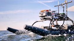
Upon completion, the vessel will offer fast transit performance, dynamic positioning, dedicated launch / recovery for OHM’s CSEM transmitter, handling of CSEM receivers to and from below decks storage facilities to preparation area and directly to the waterline, and continuous high-speed data link to shore.
“OHM has traditionally opted for survey vessels that used the portability of the OHM technology,” says Dave Pratt, OHM CEO. “However, the growing demands for our industry-leading technology and the tight shipping market have demonstrated that a dedicated survey vessel is required for the longer-term.”
Falkland plans 2D assessment, CSEM survey
Falkland Oil & Gas expects to begin assessing 10,000 km (6,214 mi) of 2D seismic work, planning a CSEM survey to begin in January, and then beginning a sea bottom coring program in February.
Wavefield InSeis was contracted for the 2D seismic survey and Offshore Hydrocarbon Mapping was contracted for the CSEM survey. This work is expected to culminate in exploration drilling by 2008.
Falkland also is planning to acquire sea bottom cores. “These will be targeted at a number of possible oil seeps that have been identified from seismic data and satellite imagery,” says Richard Liddell, chairman, and Tim Bushell, chief executive, Falkland.
“We hope to recover ‘live’ oil samples. This would demonstrate that oil has been generated and that it has migrated within the South and East Falkland basins.”
No contractor has been named to conduct the coring.
TGS starts Indonesia surveys
TGS-NOPEC Geophysical Co. ASA has begun acquisition of geoscientific surveys over Indonesia’s frontier basis. The survey will cover about 1 million sq km (386,102 sq mi) in 16 sedimentary basins, according to TGS.
The studies are scheduled to include the following:
- 33,000 km (20,505 mi) new 2D seismic data
- 419,000 sq km (161,777 sq mi) of Multibeam SeaSeep, gravity, and magnetic data
- 1,500 sediment cores
- 4,500 geochemical analyses
- 250 heat flow probes.
“This exciting new program will generate a huge amount of new data and ideas on Indonesian geology,” says R. Pryono, director of Directorate General of Oil and Gas (MIGAS), a subdivision of the Indonesian Ministry of Energy and Mineral Resources. “I am confident that as a result we will be able to rewrite the geology of Indonesia.”
The project is designed to couple new technologies with proven geologic concepts, says TGS. The gravity and magnetic data will provide information on the tectonic fabric and basement architecture in the basin while the seismic data will provide more detailed structural mapping capabilities. The Mutibeam SeaSeep data will provide a high-resolution view of seafloor topography and will be used to detect hydrocarbon seeps on the seafloor. The sediment cores, geochemical analyses, and heat probe tests will be used to evaluate the commercial viability of petroleum found in the frontier basins. The complete, integrated data package will be marketed to the exploration industry.
“The geology and petroleum potential of Indonesia’s frontier basins are not well understood by industry, with large areas written off with little or no data,” says Paul Gilleran, TGS general manager for Asia-Pacific. “Modern, integrated data can help open these frontier basins to new, ‘clever’ exploration.”
China awards gas hydrate work
Guangzhou Marine Geological Survey (GMGS) of the Ministry of Land and Resources, Peoples Republic of China has awarded Fugro Hong Kong a $9-14 million contract for drilling and sampling services involved in GMGS gas hydrate research.
GMGS expects the South China Sea to contain gas hydrates, and views that as a potential new source of energy. To assess the presence of gas hydrates, GMGS requires data on the nature of seafloor geology. Fugro will use its geotechnical investigation vessel M/VBavenit for this contract. The vessel is equipped with a DP system for work in deepwater.
Scan Geo Searcher sets company records
Scan Geophysical ASA’s 2D vessel, the M/VGeo Searcher, has set both single day and daily average production records for the company while working offshore Pakistan.
The vessel shot 232.5 km (144.4 mi) on Nov. 11, 2006, a record daily production for Scan. In addition, the vessel has shot 4,255 km (2,644 mi) in 24 days, for an average daily production of 177 km (110 mi), also a company record.
The survey was being conducted by SCAN for GEMS International NV, a Belgian and UK-based company specializing in EEZ and UNCLOS surveys.
null


