EXPLORATION TRENDS:
Northeast South America
Latin America's excitement continues to revolve around the opening of Brazil's established southeastern offshore trends. CGG announced it has begun its 4,500 sq km non-exclusive 3D survey in the Campos Basin, offshore Brazil. The M/V CGG Alize joined the M/V CGG Harmattan, which has been active in the Espirito-Santo Basin since June 1999. The M/V CGG Alize will use eight streamers to gather the data.
Often overlooked are the possibilities on the northeastern coast, until now. Several years ago, a broad geochemical study conducted by a consortium lead by Petrobras showed a possible relationship among several deepwater geological trends stretching from northeastern Venezuela and around Guyana, Suriname, and French Guinea toward Brazil's northern waters. Some of these trends may be up for exploration soon.
Recently, CGX Energy Inc. identified four targets on its 3.8-million acre Corentyne concession offshore Guyana, using older seismic surveys. The company shot new data and found both high amplitude anomalies and flat spots. It is presently high-grading two of the prospects with AVO analysis prior to drilling.
Deepwater activity has been strong offshore Trinidad and Tobago, but this is the first announcement of significant activity off Guyana. If discoveries are made in some of these trends, it may signal the opening of a new exploration frontier. Exxon has a large concession adjacent to CGX that extends into ultra-deepwater.
Costa Rican seismic
MKJ Exploration will begin a 100 sq km 3D survey of the Caribbean zone off Costa Rica. The two-block study area is over the Moin High structure. This is the first activity in the region since the first bidding round in 1997. A second round recently closed at the end of September. For more information visit www.dhg.go.cr
Indonesia survey
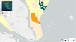
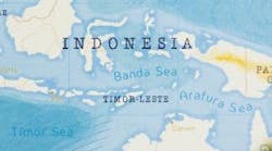
TGS-NOPEC Geophysical announced the beginning of EIR-99, a non-exclusive 2D program, near is Misool Island, Indonesia. The 3,000-km survey in a joint effort between TGS-NOPEC, Schlumberger Geco-Prakla, Migas and Petronas. The primary goal of the survey is to image the Mesozoic section offshore between the island of Misool and the deepwater Seram Trough.
TECHNOLOGY TRENDS:
Logging tools for extreme environments
Schlumberger launched a new suite of logging tools, Xtremetrademark, designed specifically for hostile environments. The tools can operate in high pressure, high temperature (HPHT) environments up to 500°F (260°C) and 25,000 psi.
The logging string can be assembled to the requirements of the individual job, but usually includes array induction, digital sonic, litho-density, epithermal array porosity, and spectral gamma ray sensors. The resistivity resolution is one foot, significantly better than conventional tools at eight-foot resolution.
Survey design
Green Mountain Geophysics, a subsidiary of Input/Output, announced the release of MESA 5.0 for the design of 2D and 3D seismic surveys. Enhancements to MESA include:
- Support for vertical geometries
- Auto-repelling exclusion zones to move stations/shots
- Geometry spreadsheets for editing designs
- Flex binning capabilities
- Numerical template editing
- Graphical layout of shot and receiver lines
- Marine output
- Optional array and migration aperture functionality.
Interpretation environment
Geographix (Halliburton/Landmark) released Geographix Discovery, an integrated geoscience interpretation environment for the geologist, geophysicist, and petrophysicist. It runs under Windows NT(R) and provides access to:
- Well information at any point in the inter pretation process
- Seismic, well, and log interpretation tools from anywhere in the environment
- A seamless flow of data and interpretations within the environment without relying on ASCII file transfers or format conversions.
With the new software the geoscientist can quickly visualize analyze, and interpret seismic, well, and log data, providing a more cohesive and accurate interpretation of the subsurface.
Virtual reality tools
Virtual reality (VR) device providers are trying to bring better sensory (haptic) input into the interpretation process. Two new devices entering the market are offered by Fakespace Systems Inc: the NeoWandtrademark and the NavPodtrademark, in addition to the previously mentioned Cubic Mousetrademark (March 1999).
The NeoWand is a handheld device for use in immersive environments that allows collaboration between viewers. The tool can be passed between different users unlike earlier controls, which were attached to the primary user. It has eleven buttons that can be used to control navigation, manipulation of virtual objects, menu viewing and selection, and other programmable functions.
The NavPod is a pedestal or desk-mounted device for use with large-scale wall or room displays. The user grips each end of a 12-in. long horizontal bar and pushes gently in the direction they wish to drive the perspective for viewing. It provides very intuitive steering for moving around a 3D VR model.
Haptic technologies will be coming soon that will allow the interpreter to "feel" data textures or attributes and their subtleties. This could be a great aid to petroleum scientists studying the intricacies of reservoir models and 4D seismic data sets.
Volume visualization
Muse Technologies in collaboration with Continuum Resources has developed a new tool, TeraViz. The software uses perceptual computing to help users make immediate sense of trends, patterns, and anomalies in large data sets. By using light, sound, and eventually touch, it permits many types of raw and complicated data to be integrated and presented.
GOM bathymetry
Texas A&M University (Bryan, Texas) is now offering NOAA bathymetry for the Gulf of Mexico on CD-ROM. The project was a joint effort by the Texas Sea Grant College Program, Texas A&M University and the National Oceanic and Atmospheric Admin istration (NOAA).
The multi-beam data include three-year surveys by NOAA and a 1990 Alaminos Canyon survey. Outside the multi-beam coverage the bathymetry is based on Petty-Ray seismic data digitized by the National Geophysical Data Center and the Mexican government.
The data is presented in ArcViewtrademark and can be run on either PC or Macintosh computers. Full color maps are available in two sizes. Contact Texas Sea Grant College Program for more information at 409-862-3767.


