GoM surveys heat up


The waters of theGulf of Mexico are once again seeing major seismic surveying activity. TGS and Schlumberger recently started the full-azimuth multi-client Revolution XII and XIII surveys.
The surveys will cover approximately 7,150 sq km (2,761 sq mi) in the Green Canyon, Atwater Valley, and Ewing Bank protraction areas of the central Gulf of Mexico.
They will be acquired using the Schlumberger WesternGeco Q-Marine point-receiver marine seismic system combined with the proprietary multi-vessel, Dual Coil Shooting acquisition technique. This will provide broadband, long-offset, full-azimuth data. This combination of technology and technique, the companies claim, will improve illumination and imaging of the subsalt and other complex geologic features.
Acquisition is expected to end in late 1Q 2017 with final processed data available in early 2018.
The two companies have a history of cooperation in the Gulf of Mexico, starting in 2008 with acquisition of the Freedom WAZ survey followed later by the Liberty WAZ and Patriot M-WAZ surveys.
These new Revolution Dual Coil Shooting full-azimuth surveys will record offsets of more than 14 km (9 mi) for imaging below the salt in the deepwater Gulf of Mexico.
Also, autonomous marine vehicles (AMV) are being deployed. These AMVs will simultaneously acquire ultra-long offsets of more than 20 km (12 mi), which benefit full waveform inversion in the accurate velocity model building over such complex subsalt areas.
Maurice Nessim, president of WesternGeco, added: “With these new techniques, we expect to see further improvements in subsalt imaging and amplitude fidelity for reservoir characterization providing value for our customers.”
Elsewhere in the Gulf, TGS also recently updated on its progress in the acquisition of its Gigante 2D survey, a 186,000-km (115,575-mi) regional 2D seismic survey covering areas in Mexico’s proposed license rounds in the Perdido, Campeche, and Mexican Ridges regions. TGS will also perform line ties to its previously acquired US Gulf of Mexico regional grids.
As of early August, the program has acquired more than 160,000 km (99,419 mi) of 2D data and almost 150,000 km (93,205 mi) of fasttrack data has already been delivered to clients.
In parallel, TGS is acquiring the Gigante multi-beam, coring and geochemical survey over a 600,000-sq km (231,661-sq mi) area.
The company increased the multi-beam fleet to two vessels during 2Q with coring operations continuing from a third vessel. By mid-year more than 50% of the data was in with the remainder of the project expected to be complete in 4Q.
Interpreted results will be integrated with the 2D seismic survey.
Both surveys are supported by industry funding.
COSL completes survey jobs
China Oilfield Services Ltd. (COSL) recently completed two jobs, in the Far East and the Barents Sea.
Faced with the persistent low oil price, while meeting demand for oil and gas exploration and development in domestic waters in China, COSL said it has been accelerating its strategy to actively compete in the international oilfield service market. It is now deriving 40% of its revenue from overseas.
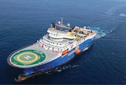
The 12-streamer vesselHYSY 720 completed an operation in the Barents Sea, more than 900 km (559 mi) above the Arctic Circle. COSL said the survey was noteworthy for several reasons. It is said to be China’s first attempt in performing 3D seismic data collection in ultra-high latitude and ultra-low-temperature waters. The company also claimed it recorded a new monthly seismic data acquisition record of 1,820.58 sq km (703 sq mi), saying this was also a record in China.
The operation lasted for 100 days and concluded in August. The environment was very complicated, with sea water mostly frozen, at 0°C even in July, it explained. COSL’s operation team manager Chen Zhiwei said: “We have no precedence to follow for this operation in North Pole. The low temperature operation, the persistent daylight and the narrow window that allowed operation to take place presented unprecedented challenges to team members and the exploration equipment.”
There is only a short window of four to five months in a year for operations in the Arctic waters, COSL said. The crew implemented a round-the-clock operation routine and tackled the impact on team members from the prolonged daylight.
In addition,HYSY 720 is the first deepwater seismic vessel proprietarily built in China, the company claims. COSL said it is “the first 12-streamer dual-source large-scale seismic vessel in China driven by diesel-electric propulsion system capable of sailing to Class 1 unlimited navigation zone around the world.”
COSL also completed its first exploration operation in the Far East, finishing a 3D seismic acquisition survey first announced in June.
“The operation situation was complicated, including the complex fishery and year-round foggy weather. Also, operating in the shallow-water zone is a threat to the underwater equipment,” COSL said.
To counteract these challenges, the company said it created what it called a “seamless solution:” preparing protection measures for the equipment according to weather and tidal cycles to lower the operation risks. COSL used theHai Yang Shi You 718 (HYSY 718) to complete the Far East campaign.
Europa: Potential in Padraig
Europa Oil & Gas claims its recently awarded three-year licensing option (LO) 16/22 offshore western Ireland could hold 300-600 MMboe of resources. The concession covers 992 sq km (383 sq mi) in the Padraig basin. Following the completion of a work program, Europa has the option to apply to the Irish authorities for conversion to a full frontier exploration license (FEL).
The company plans to further mature the prospect inventory and will seek a farm-in partner for the FEL conversion and in due course drill an exploration well, subject to a positive technical and commercial outcome from a 2D seismic reprocessing campaign.
LO 16/22 is on the eastern margin of the Rockall basin and contains numerous exploration leads in water depths of 800-2,000 m (2,624-6,562 ft). It is 300 km (186 mi) west of Ireland and 150 km (93 mi) west of the Spanish Point and Burren discoveries.
The Pre-rift oil play comprises Lower and Middle Jurassic sandstone reservoirs in large tilted fault block structures with Jurassic source rocks, with further potential for a Triassic gas play.