Guinea exploration under way in earnest
Gene Kliewer, Technology Editor, Subsea & Seismic
Hyperdynamics Corp. continues moving forward with its exploration plans over the largest single license offshore West Africa in the Republic of Guinea. The most recent step was to secure a seismic acquisition partner. Geophysical Services Inc. has agreed to invest in seismic data acquisition and processing and to work under a multi-client approach whereby data will be acquired and processed, and revenue shared for future licensing fees.
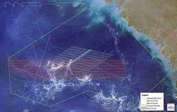
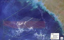
Hyperdynamics plans to acquire more than 13,000 km (8,078 mi) of 2D which will help narrow the targets for subsequent 3D. The 2D seismic program will cover three phases. Phase I (6,700 linear km or 4,163 mi) will cover a good portion of the shelf-slope on the western side of the concession.
At the same time, some 3D work is scheduled on already identified prospects to fix locations for drilling. This could start as early as late 2008 or early 1Q 2009. Hyperdynamics plans three phases of the 3D seismic coverage. Phase I will cover many of the already identified structural and stratigraphic features in Hyperdynamics’ portfolio.
This GSI agreement highlights Hyperdynamics’ welcomed quandary. The company holds all of Guinea’s offshore territory -- 31,000 sq mi (80,290 sq km) of virtually undrilled area. This is the largest single holding by far offshore West Africa, but there is little direct exploration history over the area. The Buttes Resources No. 1 is the only well, and it was drilled in 1977.
“This is a challenge,” says Kent Watts, chairman and CEO. “We are exploring for world-class oil and gas reserves in the hottest exploration region in the world. In 2008 we are focused more deeply than ever on our exploration work.”
That is not to say Hyperdynamics is just beginning its work. Starting in the second half of 2007 the company began to ramp up its exploration activity. Drawing on knowledge of the surrounding production geology and with a base formed from 2002 work by others, Hyperdynamics acquired some additional 2D seismic data from a third party in addition to gravity and electromagnetic data to reinterpret around 25 leads. This 2007 work also included re-examining satellite images of subsea oil seeps.
“Right now we have three general areas of exploration which we are pursing within the big Transform Margin play along West Africa,” says James Spear, executive VP of Exploration and Production, and chief geophysicist. “We have three provinces we are looking at: the Upper/Lower Cretaceous plays consisting of slope/mound turbidite fans in the oil province window, the Mesozoic syn-rift basin play testing natural gas, and the Tertiary prograding deltas. To date, the primary targets are the stratigraphic slope fans and turbidite mounds in the Upper Cretaceous. Of primary importance additionally are large structures identified within the Lower/Upper Cretaceous section. These structures, if filled to the spill point, offered very attractive drilling targets, given their immense size.”
These structures differ from other portions of the Transform Margin play of West Africa in that within the Lower/Upper Cretaceous section they are larger than those Spear has seen in other parts of this trend.
“We are seeing a lot of enthusiasm in the industry for the West African exploration efforts,” he says. “For instance, Kosmos Energy/Tullow Oil/Anadarko Mahogany have made discoveries in the Jubilee field. Initial projections have grown from a 250-MMbbl oil discovery into what is now a 600-MMbbl discovery.”
As Spear indicates, Hyperdynamics has a two-tier approach in place as regards to the seismic work. There is the 2D aimed at delineating the regional details, and the 3D aimed at picking specific targets.
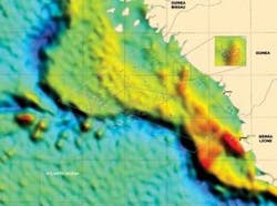
The company’s exploration efforts are not restricted to seismic work. Spear says there are gravity/magnetic surveys over the same areas in which the seismic is being acquired. Additionally, Hyperdynamics plans to conduct electromagnetic reconnaissance surveying over key targets in advance of the 3D seismic. According to Spear, Hyperdynamics also is doing remote sensing surveying via satellite studies and geochemical analyses of oil seeps offshore Guinea.
“We have seismic, gravity, magnetic, geochemical, and remote sensing all as vehicles,” says Spear. “We’ve more than accomplished our exploration goals in the early stages and want to take that to the next level. We have a model tectonically in place to realize the most potential from our exploration play. We have a model geochemically in place identifying our ‘kitchen’ and the various kerogen types with the maturation windows for the source rocks in the area. And we have a depositional model working. If we can bring that all into concert, we are at that stage to start delineating the prospects of high quality.”
Watts says Hyperdynamics’ studies comprise the largest knowledge base in existence concerning the Guinean offshore region. “Our historical exploration efforts have identified plays such as the Guinea Bissau salt province, Lower Cretaceous/Upper Cretaceous slope-fan deposits, Paleozoic tilted fault blocks, Mesozoic syn-rift half grabens, Tertiary deltas, and prograding deltas along with Tertiary channel sands,” he says. “Our exploration work since August 2007 has verified that we have the Transform Margin fairway in our concession. This is part of the same play that has produced at least 39 discoveries offshore West Africa collectively containing a world-class level of oil reserves.”
Geology explained
Spear describes the geology in Guinea based on the information available at this point as follows:
“We are looking at a series of major strike/slip faults or ‘transform faults’ as they are known. That is the name of the Transform Margin play. Thus, we are looking at complex fault blocks set up by these transform faults offshore Guinea that have acted over time to provide multiple geological targets. We can see a lot of tributaries dumping material and sediments in these fans, i.e. turbidites. Thus, we are looking at plays similar to that offshore Ghana and Ivory Coast. These are the analogs along other sections of the West African Transform Margin. Likewise, we are interested in similar play offshore Suriname on the South American side of the plate boundaries following the breakup of Pangea on the other side of the North Atlantic basin.”
One of the major transform faults is the Guinea transform fault. There is a series of them and Hyperdynamics is examining how this tectonically sets up fault blocks as targets in this portion of the offshore Republic of Guinea. Mapping several fault plane maps, Spear modeled the plays showing the fault offsets and the matching strata for the depocenters within these fault blocks.
“This would be like the early Mesozoic rift or pre-rift in Jurassic time and this provides our portfolio of prospects within our deepest play positionally, stratigraphically speaking,” he says. “You can ascertain the secondary targets within this post-rift section. You get a lot of lacustrine-type deposition occurring, or lake-like deposits acting as in-fills in the half grabens. This is the working model for our secondary plays and these targets fall within the ‘gas window’ of the maturation thermal gradients for the ‘kitchen’ in this region.
“The transform faults formed as the mid-Atlantic ridge parted in the late Jurassic as Africa, South America, Europe, and North America began to separate from Pangea. The Jurassic was in a dry period. The way the continents were oriented at the equator and the wind belts, there was a lot of evaporation. That is important because we see some structures like salt diapirs. We are looking at salt diapirs as one of our targets. There already have been areas of investigation and drilling north of us.”
There are three types of plays, Spear explains. The principal play is within the Upper Cretaceous section and is stratigraphic in nature. Spear believes these are among the best of their portfolio of stratigraphic-type plays within the Upper Cretaceous section of the shelf/slope region of its concession. The targets in the Upper Cretaceous zone are turbiditic slope-fans and mounds which are the type of structures in which several oil and gas operators have already made many discoveries along the West African coast. Newly acquired seismic lines already have added support for many of these previously identified targets of interest.
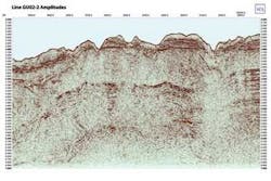
“Another model shows how sediment moves from the shelf to the slope adding material to these mounds,” Spear says. “There are tributaries of onshore rivers dumping deposits and the deposits being pushed off the shelf onto the slope. You get these turbidite mounds. This work shows what some of the turbiditic mounds look like in position in our region of the world. We’ll be doing a lot of amplitude extraction work and seismic attribute analysis with 3D seismic interpretation when we get to that stage. Basically, we are starting to map the seismic facies of these mound-like features. To date, we have mapped more than 10 prospects within this portfolio.”
Hyperdynamics also is doing AVO analysis looking for seismic signatures, particularly the mounds and the lobes associated with the stratigraphic features.
“We’ve seen the same kind of thing offshore Republic of Guinea as those, Petrobras is drilling in Santos and Espirito Santo basins offshore Brazil,” Spear says. “We have good analog models to work from. Today’s seismic analysis enables one to recognize those targets with good resolution using 80-fold and 120-fold seismic data.”
New data contributions
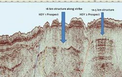
Additionally, with the new 2008 seismic data starting to be received, Spear has confirmed that deeper, very large structural traps are delineated within the Lower Cretaceous section. Futher evidence supports the immense size of these structures, he says. Previously disclosed in the last few months, Hyperdynamcis had identified a structure 16 km (10 mi) across. At this time, an adjacent structure has been delineated that is estimated to be 17 km (10.5 mi) long and approximately 8 km (5 mi) wide. The combined size is estimated at 33 km (20.5 mi) by 8 km.
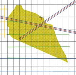
Over the next few months, Spear says, new leads are expected to be identified while existing leads are high-graded and confirmed. With the additional reconnaissance provided by the current 2008 2D acquisition, the preliminary 3D seismic grid, laid out this last winter, can be customized to cover the most interesting prospects believed to have the greatest potential for world class reserves. The company plans to acquire the first 3D seismic in the history of offshore Guinea later this year. Once this 3D is acquired, processed, and interpreted, Hyperdynamics expects to have a significant portfolio of prime prospects to drill.
Currently, magnetic and gravimetric coverages over the concession area are under way as well. “We’re going to be filling in the magnetic coverage and likewise enhancing both our gravity and our magnetic gridding,” Spear says.
Regarding geochemical studies to date, Spear thinks there’s a lot of potential from the source rocks present.
“There have to be good hydrocarbon traps here,” he says. “We have good evidence of this ‘kitchen’ here with many oil seeps and plumes.” Hyperdynamics did this study with the Infoterra group in 2006.
Another report returned in October 2007 from MDA Federal, or what was the Earthfield Satellite Group out of Beltsville, Maryland. Both of these studies encourage Spears’ optimism.
“It is impressive to see how much continental shelf there is off the Republic of Guinea,” he says. “It is unique in that sense. What is important here is that the greater part, what we call the outboard region, is where the large structural targets are located and is more unique than along other portions of a thinner shelf developed offshore the other parts of the Transform Margin play south of us.
“It is very active tectonically, so we see in the tectonic province of this region both the compressional and we have superimposed upon this region extensional tectonics emplaced. Both tectonic regimes are active. You can see some of these signatures of these lineaments that are some of the transform faults coming from onshore to offshore. There is a whole series of them. What we have to find now is how extensive these major lineaments are and how they intersect with the transform faults from offshore.”
This is Hyperdynamics’ secondary play.
There is a major non-conformity, the Cenomonian Unconformity. This is the Lower Cretaceous unconformity and the zone immediately above it is the Lower Cretaceous.
“The primary zone of our play is between this unconformity up to and including the Upper Cretaceous,” Spear says. “We are looking at targets in this zone as our primary targets and in the Mesozoic syn-rift as our secondary targets. And above that is the Tertiary section, which is our third type of play. The Tertiary is where we see some of the biogenic gas (rather than thermogenic in nature as is the case with the Mesozoic play) plays occurring, so if there are reserves here, they will be gas fields and probably not large in gas reserves. We do see some others that have a larger gas potential in the 5 Tcf size range within the Mesozoic section.
“We also see several diapirs on the current seismic profiles. We have targets on the flank sides and we know just to the north of us in the Guinea Bissau area there were three wells drilled, one of them a sidetrack, and all found oil shows, just not commercial quantities. It looks like there was no cap to trap the oil and it escaped out of the petroleum system. In other words, the system was breached.
“I’ve seen three different diapirs just by coincidence of where the 2D lines were shot and none of them go to the surface (as the ones drilled to the north); thus, meaning the oil would be trapped and not escape as in a seep. I was able to interpret all the way down to the basement on the 2002-2003 2D survey.
“I always like finding old paleo highs because where you find them, lots of times you find targets above them. In the Mesozoic syn-rift basin we have a series of grabens and then we have a hinge line which has some measurable affect on the tectonics here. The part about this play, our secondary play, is that nobody has drilled as yet any of these targets. This is our ‘rank wildcat area’. The Mesozoic syn-rift basins have as yet not been drilled. This play remains an interesting target. By reason of the setting, we have some targets where we can drill through all three targets and we intend to do that very thing from the Tertiary, thru the Upper Cretaceous/Lower Cretaceous and into the Mesozoic syn-rift basins.”
The Republic of Guinea has much to gain from the success of this exploration. The country holds one of the richest and most important bauxite deposits known. The mining industry accounts for most of the current wealth and GNP of the nation and gas generation plants are needed to develop this production, along with other minerals being mined.
“Hyperdynamics sees a great potential to both explore and exploit our concession over the next many years through to the year 2018 when our license can be renewed by the government of Guinea. With our most robust program of seismic and other reconnaissance tools being used, we have expectations of a large drilling program ahead of us for many years to come,” Spear concludes.
