Finding the 'right match' is critical
Keith Watt
Concept Systems
"It's never the same the second time!" That was the assumption that Concept Systems had to make when working with Shell Expro on a project to solve the problem of "repeatability" in 4D offshore seismic surveys. It proved to be the key to developing the first effective technique that ensures that data from 3D surveys carried out at separate times over the same oilfield location can be accurately compared, with observed differences being understood and resolved.
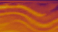
4D seismic involves repeated 3D seismic surveys carried out every so often over a targeted reservoir to image the movement of hydrocarbon fluids. If accurate, the results allow oil companies to focus their drilling and other measures more precisely to optimize production and net millions of dollars in additional recoverable reserves. The promise of 4D seismic, or time-lapse 3D seismic, has been slow to catch on in the industry, partly because oil companies are not persuaded that the technology can deliver the truly repeatable surveys to justify the investment. It is also perceived to be expensive.
The challenge was to find a way of ensuring that new surveys for 4D seismic analysis mirrored as closely as possible the acquisition parameters of the earlier survey. Studies showed that variations in factors such as survey geometry, weather, and tides could all introduce significant positional errors into the repeat survey.
The direction the research project followed was to develop a solution from Concept's existing Reflex navigation and positioning data handling system for seismic operations.
Concept delivered the technology and communications system to Shell Expro to enable suspect data coverage areas to be reshot as "4D infill" while the seismic vessel was still on station. Shell Expro's geophysicists onshore were able to make "infill" decisions during a 4D seismic survey based on data analysis relayed to them using a secure web-services site.
The technology was used in all of Shell Expro's 4D seismic survey work conducted last year in the North Sea will be deployed again this year. In addition, Shell's operations in the Gulf of Mexico are adopting the technique. It was also applied to aid post-survey seismic processing, allowing geophysicists to understand the detailed repeatability issues with the data before and during processing.
The technology
The key to the technique is to make the assumption that it will be impossible to repeat two surveys identically. The differences in position of the sources and receivers of any new survey will be a significant source of error that flows right through to the final 4D seismic data set. A very important aspect of the technique is to correlate the repeatability results with measures of quality extracted from the final processed 4D seismic results.
Understanding this relationship allows the geophysicist to interpret the results, knowing that this will have a direct bearing on the final 4D product.
Measuring repeatability is not a trivial task. It involves processing every source/receiver pair in the monitor dataset (the new 4D survey) looking for the "best" matched trace in the baseline (the original 3D survey). This may entail many billions of computations to complete the analysis for an entire 4D survey. With such a mind-boggling quantity of data, the need for an efficient spatial access engine for position and attribute data is critical to success. Reflex, Concept's coverage and attribute analysis system, proved suitable for the task.
A matching algorithm is at the heart of the new technology. This mechanism controls the selection of the traces to be matched. At its most basic, a simple matching function could look for the closest trace in the baseline survey. In reality, the matching function is a more complex algorithm taking into account a combination of many of the acquisition attributes stored in the database such as source and receiver position. Once these trace pairs have been identified, statistics are generated for the selected traces and are then binned and logged for subsequent detailed spatial analysis.
During the surveys, data was sent into a secure services website at regular intervals from the seismic vessel. Rapid turnaround and web delivery then made it possible for Shell's team to analyze the results and make important decisions on infill while the survey was underway.
The R&D project highlighted that the repeatability factor is becoming a crucial part of the whole 4D process, from the initial design/planning phase, through acquisition, and into the final processing. It forms an important element in the geophysicist's understanding of the survey and how decisions will affect the final 4D product.
Planning
During the planning phase of a 4D project, differences in the new acquisition geometry can lead to repeatability problems. These differences can arise from the fact that the new data is likely to be acquired with more economic – dual source, six-10 streamer array – acquisition geometry than an original baseline survey shot 10 years ago with a more basic geometry – single source, two streamers.
Differences can also occur because the baseline acquisition was shot in a clear pre-production area uncluttered by facilities, while the monitor survey has to be designed around new offshore installations. This may involve complex undershooting. In either of these cases, the impact of design decisions on repeatability can be measured and understood.
In addition, post-mortem analysis of previous 4D data sets, from similar geographic or geological areas with a known set of 4D seismic results, can be helpful in providing a detailed understanding of the potential issues and how they may impact the 4D acquisition.
Acquisition technique
Conventional 3D seismic acquisition makes use of common midpoint (CMP) based binning analysis, where crews steer the vessel for coverage, using real-time-binning displays to assist them. Infill is usually specified in a survey contract to fill any offset holes that exceed the stated limits, i.e., steering corrections made to counter feather effects can lead to improved coverage but can have significant consequences for the repeatability of the data set.
When shooting 4D for repeatability, the way an acquisition program is managed has to change. Analysis of repeatability, rather than purely analyzing CMP coverage, becomes a critical focus. In the North Sea example, the overall repeatability for an offset zone around ~950 m is based on the best-matched traces. The areas in blue indicate where the repeatability is poor.
The next task was to identify the source of the problem. This was achieved by analyzing the detailed attribute maps to understand the difference and allow the planning of 4D to improve the dataset.
Comparing the difference in the crossline source position and the difference in the crossline receiver position (see figures) with the overall repeatability, it is clear that the repeatability error is predominately from the crossline source positioning. Once understood, this information can be used to plan a new line aimed at rectifying the issue.
This analysis led to the decision to shoot 4D infill targeted over the areas A-A and B-B leading to an improvement in the repeatability of the data set.
Processing
During the data processing stage after survey acquisition, the geophysicist is interested in using the technique to indicate the initial quality of the 4D repeatability, based on the correlation between repeatability maps and the final processed seismic quality. Clearly, for repeatability, there is no single answer, and the output is directly related to the matching function. Once this correlation is understood, the processing geophysicist can modify the matching function (or matching function parameterization) to see how the use of a different trace selection method may improve the view of the repeatability and thus lead to a better final 4D product.
The future
As the technology moves from the research arena into a production environment, there are a number of directions in which the technology could evolve:
- Real-time: Analysis of repeatability in true real-time in the field, along with the relevant quality control displays, will give rise to replacing the current CMP-based steering when acquiring 4D seismic
- Subsurface: Currently the repeatability analysis is processed on the surface. A logical extension of the technique is to analyze the repeatability in the subsurface (common reflection point) domain. To make use of this in an efficient manner, very fast illumination technology is a critical factor. The technology is designed to make use of illumination technologies
- Automation: The automation of detailed attribute analysis will reduce the effort in finding the repeatability issues to any particular problem.
Conclusion
The technology that Concept developed with Shell has been applied to more than 14 4D surveys and shows that:
- The value of a 4D project is considerably enhanced by understanding the repeatability of the survey
- Repeatability is affected and can be assessed by an effective "matching algorithm"
- Repeatability has relevance throughout the 4D process from planning through acquisition and processing.
Acknowledgement
Concept Systems would like to thank Shell for permission to publish this article.
Author
Keith Watt is a senior product manager with Concept Systems, responsible for the company's Reflex and Illuminator products and services.


