Offshore staff
FORT WILLIAM, UK – Four subsea contractors have held trials of a new underwater surveying technique that could speed up mapping of subsea structures and offshore sites.
DOF Subsea, Sonardyne,2G Robotics, and Seatronics staged the demonstrations at The Underwater Centre in Fort William, western Scotland, to showcase the capabilities of Dynamic Mobile Mapping.
This combines 2G Robotics’ ULS 500 Pro Laser, Sonardyne’s SPRINT acoustically-aided inertial navigation sensor, and DOF Subsea’s Metro software, each said to be proven in their respective fields.
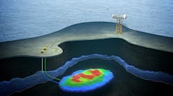
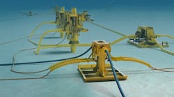
The solution is ROV-mounted. Mapping operations are conducted while the vehicle is in motion to simultaneously survey multiple horizontal or vertical flanges.
Underwater metrology involves taking accurate, precise, and robust measurements. By combining the 3D laser data with precise underwater acoustic and inertial navigation information, the solution is said to generate high-resolution engineering models from which accurate measurements can be instantaneously and repeatedly captured.
This should benefit fabrication and installation of spools and jumpers, resulting in cost and time savings.
Colin Cameron of DOF Subsea said: “We believe that using this combination of technology to provide a full metrology solution is an industry first - we can save days on traditional metrology work, and provide much higher quality data. This in turn brings savings to the operations teams running the projects.”
Benefits are said to include:
- Non-Intrusive – no prior subsea intervention is required in advance of metrology, and there is no need for subsea bracketry, control spheres, or metrology aids
- Flexible deployment – the modular system can be fitted easily to an ROV for dynamic data acquisition, or mounted on a tripod for static data acquisition
- Time to survey significantly reduced (and therefore also vessel cost) for gathering data in comparison to traditional techniques such as pure acoustic LBL; typically less than three hours for a laser metrology
- Fast delivery of results offshore; typically within six hours of data acquisition
- Inferred metrology – with prior dimensional control information, hub position and orientation can be inferred using laser scan data.
01/04/2017