Offshore staff
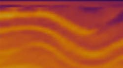
HOUSTON – ION Geophysical says it has acquired an additional 5,200 km (3,231 mi) of regional seismic data offshore northeast Greenland, bringing the total kilometers the company has acquired in the region over the last two seasons to nearly 18,000 (11,187 mi).
The company says that the successful acquisition, during an extremely challenging ice year, was further validation of its proprietary, purpose-designed marine streamer technology that enables data acquisition in the presence of ice. This technology, coupled with ION’s Arctic program management expertise, enabled the company to acquire data further north and in the presence of heavier ice than had been previously possible, at the same time mitigating HSE risk and reducing cycle time.
In addition to its Northeast Greenland survey, the company was also engaged during the summer season in the 2011 Arctic Expedition at the Exclusive Economic Zone of the Russian Federation. The survey was performed by order of the Federal Subsoil Resources Management Agency, under the guidance of the State Research Navigation and Hydrographic Institute, in support of submission of Russia to the U.N. for extension of the limits of the continental shelf. Seismic data (approximately 6,000 km, or 3,729) was acquired over 57 days, culminating in the acquisition of data at a distance of less than 300 km (186 mi) of the North Pole.
ION says that its regional exploration teams now have more than 55,000 km (34,182 mi) of deeply imaged seismic data in the Arctic region covering the Beaufort-MacKenzie, Banks Island, Chukchi, East Greenland Rift, and Danmarkshavn basins. The company plans to deliver the Northeast Greenland data in the first quarter of 2012, in time for the 2012 Northeast Greenland licensing round.
11/1/2011


